Mass 50 Public Peaks rank: #42
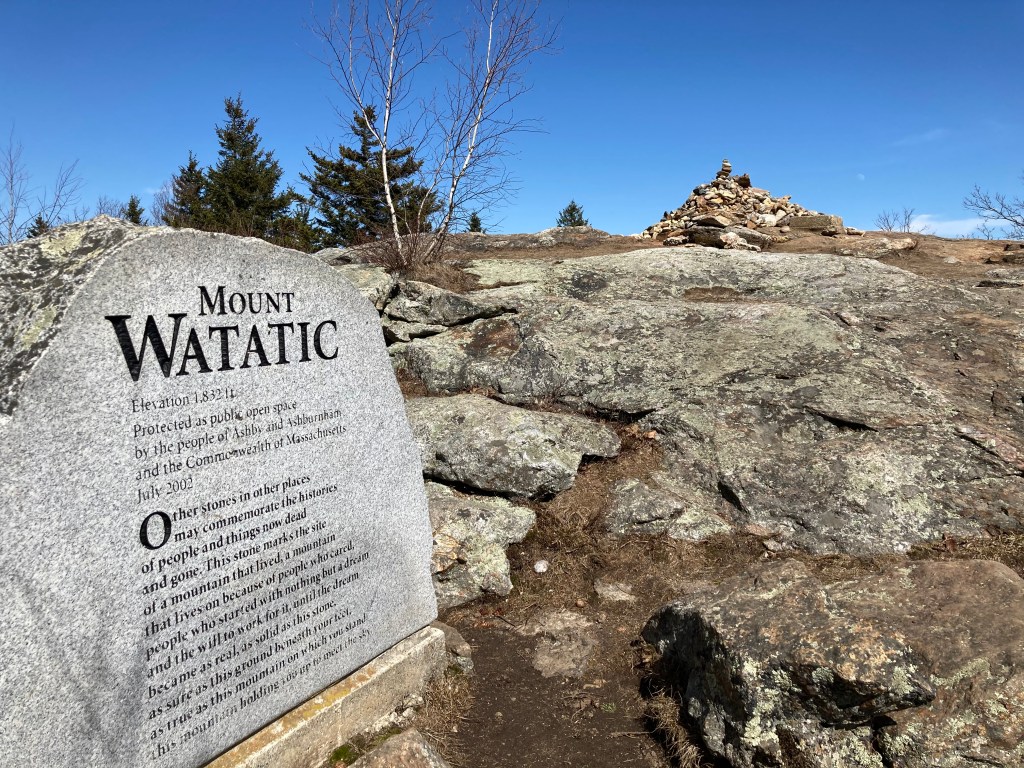
Elevation: 1,838 feet
Prominence: 509 feet
Isolation: 3.5 miles
Summit coordinates: 42°41’48.0″N 71°53’33.0″W
Town: Ashburnham, Massachusetts
Conservation Area: Mount Watatic Reservation and Ashburnham State Forest
Links:
Mount Watatic on Peakbagger
Mount Watatic on Listsof John
Mount Watatic on Wikipedia
Mount Watatic on Alltrails
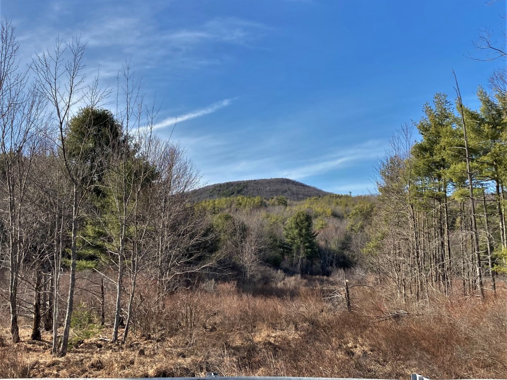
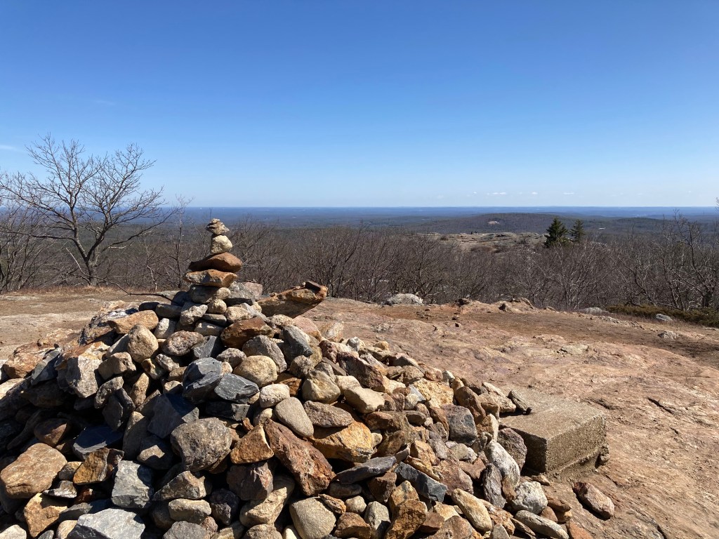
General info: Mount Watatic, the eastern-most of the Massachusetts 50 Highest Public Peaks is a prominent monadnock located at the southern end of the Wapack Range, straddling the towns of Ashburnham and Ashby in Massachusetts. It is known for its excellent network of trails and panoramic summit views, making it a popular destination for hikers. A very rewarding summit, but it tends to be crowded. The Wapack Range is a 21-mile mountain ridge stretching from Ashburnham, Massachusetts, north to Greenfield, New Hampshire. It forms a natural divide between the Merrimack and Connecticut River watersheds and features notable mountains like Mount Watatic, Mount Monadnock, Pack Monadnock, and North Pack Monadnock. The range is home to the historic Wapack Trail, one of the oldest long-distance hiking trails in the U.S., established in 1923. For those interesting in bagging county highpoints, the Middlesex County highpoint is located within this reservation of the slope of adjacent Nutting Mountain (although I’m not crazy about slope high-points).
Historical background: The name Watatic is widely believed to derive from the Native American term Wetu-tick, meaning “dwelling brook,” originally referring to a nearby stream before it was applied to the mountain and the pond at its base. The peak lies at the southern end of the Wapack Range, a long ridge that was part of the traditional hunting and travel landscape of Algonquian-speaking peoples in this region prior to European settlement. By the early 20th century, Mount Watatic had gained prominence not just as a landscape feature but as an observation point. A fire lookout tower was erected on the summit as early as 1916 to watch for forest fires in the surrounding woods, with telephone lines running up both the Ashby and Ashburnham sides; portions of the tower and its associated lines were active for decades, and local newspapers of the era frequently report fire wardens on duty responding to sightings from the summit station.
In the mid-20th century the mountain became a recreation destination with the establishment of a ski area that began with a rope tow in the 1930s and grew substantially by the 1960s. At its peak, the Mount Watatic Ski Area featured multiple rope tows and T-bars, snowmaking, night skiing, and later double chairlifts, making it one of the larger ski operations in eastern Massachusetts at the time. Intensified competition from bigger resorts, particularly Wachusett Mountain, combined with its relatively remote road access, led to the ski area’s closure in 1984. Remnants of old lifts, trail cuts, and lodge foundations are still visible on the mountain today.
By 2000, the summit had changed hands with a communications company intending to install a cell tower and access road. In response, a coalition of land trusts, municipalities, and state agencies—including the Ashby Land Trust, Ashburnham Conservation Trust, the towns of Ashby and Ashburnham, the Massachusetts Department of Conservation and Recreation, and the Department of Fish and Wildlife—came together to purchase the property for conservation in 2002, permanently protecting roughly 280 acres of ridgeline and ensuring public access for hiking and wildlife observation.
Recommended ascent routes:
Wapack Loop–I followed this loop on my visit to Mount Watatic. Plenty of parking at the Ashburnham State Forest parking area on Route 119. Great views from the peak. Nice woods around Nutting Mountain. I remember the State Line Trail along the west side of this route being very washed out and the trail bed full of rocky rubble, a little difficult. But otherwise, this is a real pleasure of a day hike.
Nearby Listed Peaks: Being the easternmost of the Massachusetts 50 Highest peaks by far, there are no other listed peaks in reasonable hiking distance from Mount Watatic. The closest is Mount Wachusett, about a 30 minute drive away. But if you want to summit some peaks in New Hampshire, you can certainly continue north from Watatic along the very popular Wapack Trail.
Back to Massachusetts 50 Highest Public Peaks list
Click to enlarge photos:


Leave a reply to profbrad Cancel reply