Elevation: 1,103 feet
Prominence: 788 feet
Isolation: 5.82 miles
Summit coordinates: 42°18′20″N 72°30′37″W
Town: Amherst and Granby, Massachusetts
Conservation Area: Mount Holyoke Range State Park
Links:
Mount Norwottuck on Peakbagger
Mount Norwottuck on ListsofJohn
Mount Norwottuck on AllTrails
Mount Holyoke Range State Park website (including trail map)
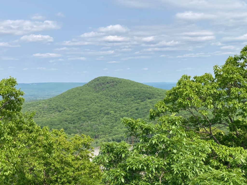
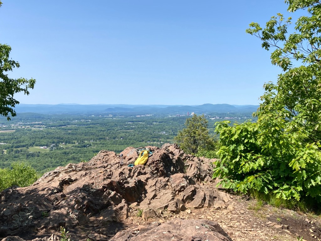
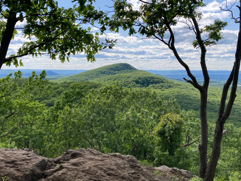
General info: Mount Norwottuck is the highest summit on the Holyoke Range, a narrow east–west traprock ridge running along the south edge of Amherst in the Pioneer Valley. Rising about 1,000 feet above the surrounding farmland and the Fort River lowlands, it offers broad views north to Amherst and Sunderland, east toward Belchertown and Quabbin, and south over the wooded spine of Long Mountain. Norwottuck sits within Mount Holyoke Range State Park, part of a larger protected corridor of more than 3,000 acres of public land stretching from the Notch to Skinner State Park on Mount Holyoke.
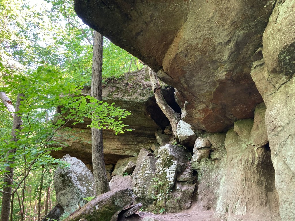
Geologically, Norwottuck is traprock: a tilted block of Jurassic basalt, about 200 million years old, that forms sheer ledges and warm, dry ridgetop “islands” above the cooler forests below. Just below the summit, the weaker sedimentary layer has eroded out to form the well-known “Horse Caves”, a dramatic overhanging rock shelter (more on the history of that below).
Norwottuck offers striking scenery and a satisfying climb without a full day of effort, one of the best easily accessible peaks in western Massachusetts. The summit can be reached on a moderate half-day loop hike from the Notch Visitor Center with the option to visit the Horse Caves en route. Trails are generally well marked but can be rocky, steep, and ledgy in places—especially near the Horse Caves. The payoff is a compact loop with classic Holyoke Range scenery: basalt ledges, mixed hardwood forest, and big sky views that feel surprisingly remote given how close you are to Amherst and the UMass campus.
Historical background: The broader region around what is now Northampton and Amherst formed part of the homeland known as Nonotuck (or Norwottuck), along both sides of the Connecticut River, with Indigenous occupation stretching back more than 10,000 years. Seasonal use of upland ridges like the Holyoke Range for hunting, foraging, and travel would have been part of that cultural landscape.
The current name comes from Edward Hitchcock (1793-1864), Amherst College geologist and early interpreter of the Holyoke Range’s traprock scenery. In the mid-1800s Hitchcock renamed several local features to reflect Indigenous terms and his own taste for “scenographical geology,” rechristening the peak Mount Norwottuck (it had previously been called Hilliard Knob) and promoting the range as a kind of outdoor classroom. Hitchcock was also one of the first to describe the spectacular dinosaur trackways found in nearby Holyoke, Massachusetts sandstone and to (incorrectly but imaginatively) attribute them to giant prehistoric birds (although as we now know, he wasn’t far off).
Just below Norwottuck’s summit lie the Horse Caves, not proper caves but a series of tall overhangs in the eroded sedimentary layer. Local tradition holds that these shelters served as a bivouac for participants in Shays’ Rebellion in 1786, when western Massachusetts farmers rose in armed protest against debt enforcement and high taxes. After their failed attempt to capture the Springfield Armory, the rebels took to the hills and according to tradition, Mount Norwottuck’s overhangs provided shelter for a large part of the force. Whether or not the story is accurate, the association has stuck, and the caves remain one of the most famous historic features on the Holyoke Range.
Modern conservation of the peak is tied to the creation of Mount Holyoke Range State Park, which grew out of state land acquisitions beginning in the 1940s and accelerated in the 1970s to protect the ridge from quarrying and development. Today, Norwottuck is a key high point on the New England National Scenic Trail, designated in 2009, which threads along the Metacomet Ridge from Connecticut into the Pioneer Valley.
Recommended ascent routes: The most sensible spot to begin any loop that includes Mount Norwottuck is the Notch Visitors Center on Route 116 where there is plenty of parking and a small seasonal museum with maps, water, and restrooms.
Mount Norwottuck Loop: Probably the most direct and efficient loop runs along the New England Trail east from the Visitors Center directly to the summit. Then, descending the eastern side past the Horse Caves, the NET links up with the Robert Frost Trail, follow that westward back to the Visitors Center for an enjoyable and family-friendly hike of 3.7 miles and about 750 of elevation gain.
Mount Norwottuck and Long Mountain: A longer and more ambitious out-and-back will take you to the summits of the two easternmost peaks in the Holyoke Range: Norwottuck and Long Mountain. Also starting at the Visitors Center, simply follow the New England Trail up and over Norwottuck and beyond to Long Mountain. Double-back for a hike of about 4.5 miles and 1,200 feet in elevation gain.
There are many trails and many other ways to explore the Holyoke Range. Enjoy!
Click to enlarge photos:

Leave a comment