Highest Point in Bristol County, MA
Elevation: 398 feet
Prominence: 100 feet
Isolation: 1.6 miles
Summit coordinates: 42° 0′ 5” N, 71° 18′ 51” W
Town: North Attleborough, Massachusetts
Conservation Area: Town-owned World War I Memorial Park & Zoo
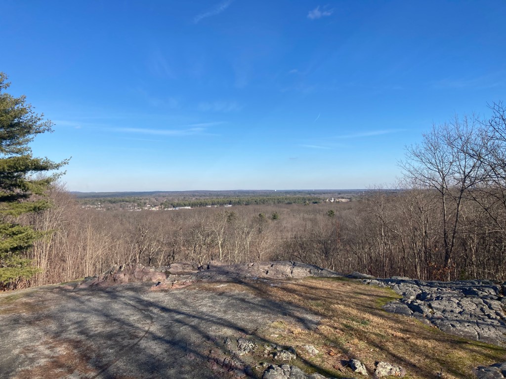
General info: Sunrise Hill is situated in the northern part of North Attleborough within the World War I Memorial Park – the town’s largest park. This modest hill is the highest point in North Attleborough and Bristol County. The hill rises from otherwise gentle terrain, giving it a prominence that allows for a nice lookout near the summit. On clear days, one can see for miles across the mostly flat southeastern Massachusetts landscape. The summit area itself is partially wooded. The hill features a park, small petting zoo, arboretum plantings, walking trails, frisbee golf range, and other recreational activities. It’s a busy place. Parking is essentially at the peak of the hill, which doesn’t make for much of a hike. But there are trails leading down the hill which allow a bit of a hike (walk?). There is a fire tower near the summit that is fenced off and not open to the public. Best as I could figure, the true summit is on a wooded knoll just north of the main lookout.
Historical background: The area around Sunrise Hill was originally traversed by Indigenous peoples long before colonial settlement. In fact, a major Native American route known as the Bay Path passed through what is now North Attleborough, connecting Massachusetts Bay to Narragansett Bay. In the 17th century, English colonists acquired this land (from the Pokanoket tribe) and it became part of the early settlement of Rehoboth.
In the 20th century, Sunrise Hill’s prominence made it a natural site for community use and memorials. The hilltop land was developed into World War I Memorial Park in the late 1960s. A small zoo was started on the slope in 1968 with just a pair of deer, and soon after, the park was formally established. On November 8, 1970, a memorial plaque was dedicated on Sunrise Hill to Pvt. Edward P. Nolan, a local veteran whose efforts had been instrumental in creating the park. Around the same time, the town installed a ski area on the hillside, taking advantage of Sunrise Hill’s slope. The Sunrise Hill Ski Area operated sporadically from about 1970 into the early 2000s. It featured two short ski trails and a J-bar lift. However, due to Bristol County’s marginal snow conditions and a small vertical drop, the ski tow ran only intermittently. By the early 2000s the ski area was effectively closed, and the slope became a popular sledding spot instead.
The summit’s fire lookout tower was erected mid-century (circa 1960s) by the Massachusetts Bureau of Forest Fire Control, to fill a gap in wildfire surveillance coverage. It has the distinction of being one of the last fire towers built in the state for this purpose. The North Attleborough tower was staffed until the 1970s, after which it was placed on standby status as aerial detection became more common. Today the tower still stands atop Sunrise Hill as a historical structure, even though it is no longer regularly used for fire watching.
Recommended ascent routes:
The Quick Way: The parking areas sit practically on top of the hill. You could easily park, stroll over to the Overlook for its pleasant view, then step northward up through a bit of brush to touch the true high point. But where’s the fun in that? So instead…
South Loop Trail: To actually make this a bit of a hike, I recommend finding the South Loop Trail (there’s plenty of signage from the parking area directing you there). This will take you down the slight slope through some pleasant woodland. I decided to divert back up the hill through the wooded Disc Gold Course. I felt a bit like I was intruding on people’s games, but it’s essentially the only way to get back to the parking area. All in all it was a loop of about 1.6 miles and 151 feet in elevation gain. It at least felt like one had climbed something.

Leave a comment