Mass 50 Public Peaks elevation rank: #32
Elevation: 2,035 feet
Prominence: 220 feet
Isolation: 1.4 miles
Summit coordinates: 42°07’57.7″N 73°27’26.0″W
Town: Mount Washington, Massachusetts
Conservation Area: Mount Darby Preserve, Berkshire Natural Resources Council
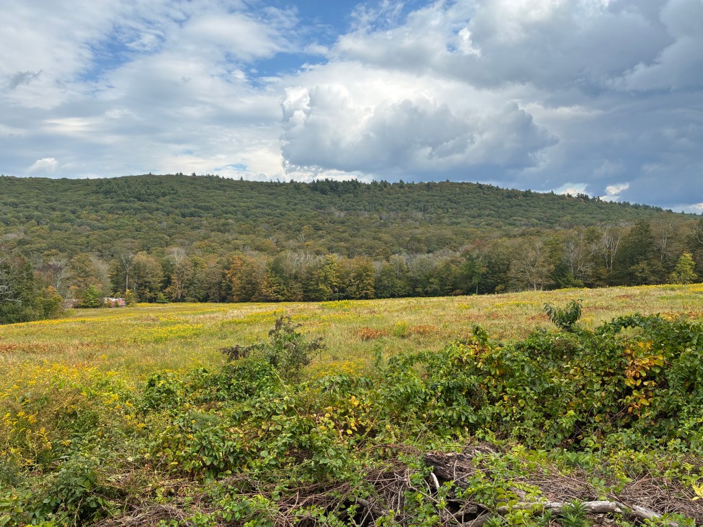
General info: Mount Darby may not be the most thrilling of the peaks on this list. It is surrounded by more conspicuous neighbors (Alander, Everett, Race, Prospect Hill) with large trail networks and lots of sights to see. By contrast, Mount Darby’s summit is wooded and without a view. It is known for particularly dense laurel thickets and therefore the only route up is a heavily rutted dirt access road. A walk up this road from East Street is short, about 1.5 miles out and back with about 375 feet of elevation gain. A cluster of communication masts stands not far from the high point. So, it’s not the most majestic Massachusetts hike. It is, however, a prominent peak over 2000’ on public land known as the Mount Darby Reserve managed by the Berkshire Natural Resources Council and these attributes solidly earn it a place among the Massachusetts 50 Highest Public Peaks. The Darby Reserve is part of a larger 17,000-acre network of protected lands spanning three states (MA, NY, and CT). The mountain directly abuts Mount Washington State Forest and Jug End State Reservation contributing to a vast unbroken forest. There is some great hiking in this area and a quick jaunt up Mount Darby should definitely be paired with another peak, whether Alander Mountain, Mount Bushnell, or even the big guy, Mount Everett, which dominates the skyline in the southern Taconics. Parking at the foot of the utility road is a little tricky, but there is room off to the side—just be sure not to block the access road. The BNRC site and others mention that parking is permitted here for hikers.
Historical background: Mount Darby sits on the ancestral homeland of the Mohican people, who inhabited the Berkshire Taconic region for centuries prior to European colonization. The rugged terrain of the town of Mount Washington was only sparsely settled by colonists in the late 18th century (the town incorporated in 1779) and remained remote and lightly developed.
In the mid 18th century, the area was embroiled in a border conflict between Massachusetts and New York settlers with rival claims. Jonathan Darby emerged as a prominent leader on the Massachusetts side of this conflict. His house in the Taconics became the site of a major confrontation when a band of armed Massachusetts settlers gathered there. When New York authorities arrived with a force that included a deputy sheriff and constables, Darby’s men fired from loopholes cut into the house, wounding several and killing two. The exact location of Darby’s home is now unknown, but his role as a central figure in these clashes mark him as one of the key rebel leaders of the conflict. It seems clear that nearby Mount Darby was named in his honor.
During the 1800s, while lower valleys were farmed, the steep and rocky slopes of peaks like Darby saw little permanent clearing or industry, allowing the forests to largely regenerate by the 20th century. In 1958 Massachusetts established Mount Washington State Forest, protecting large tracts of the southern Taconics (including Mount Everett and Alander Mountain). However, Mount Darby itself remained in private ownership for decades thereafter. By the early 2000s, it was noted as one of the last unprotected major summits in the area. This changed in 2010, when a partnership between the Berkshire Natural Resources Council, Massachusetts Department of Fish and Game, and The Nature Conservancy acquired roughly 350 acres on Mount Darby for permanent conservation, public recreation, and wildlife habitat protection. The communication towers and their immediate footprint are excluded from the BNRC purchase and are, of course, off limits. But they do not occupy the precise highpoint of Darby, so the true summit is still accessible.
Recommended ascent routes:
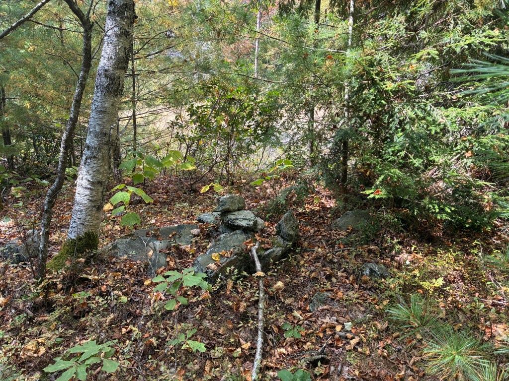
Mount Darby Utility Road: The gated access road off East Street provides the only public hiking route to the summit. This dirt road climbs about 0.7 mi through thick oak and laurel forest to reach the radio tower clearing. As there are no maintained trails, hikers must follow this utility road, which has a moderately steep but steady grade. The ascent is short (roughly 1.4 miles round-trip) with about 375 feet of elevation gain, making it a quick hike. At the summit, the dirt road forks with one short stretch continuing straight, and another branching off to the right and down just slightly towards the antennas. Follow the road straight ahead to its endpoint in a small, round, sandy clearing. The natural highpoint appears to be off to the right side of this clearing and just inside the tree-line where there is a small pile of rocks.
Nearby Listed Peaks: Prospect Hill, Mount Everett, Mount Race and Alander Mountain all have trailheads that are just a short drive away. Prospect Hill is close enough that it could be paired on a single hike, though much of that would need to be along roads (mostly unpaved). Bash Bish Falls, though not a summit, is one of the most popular hiking destinations in the area and is quite nearby Mount Darby.

Leave a comment