Highest Point in Norfolk County, MA
Elevation: 635 feet
Prominence: 482 feet
Isolation: 25.88 miles
Summit coordinates: 42° 12′ 44” N, 71° 6′ 51” W
Town: Milton, Massachusetts
Conservation Area: Blue Hills Reservation
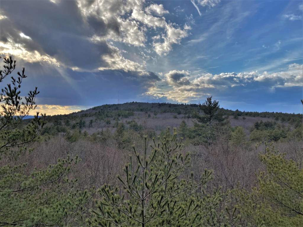
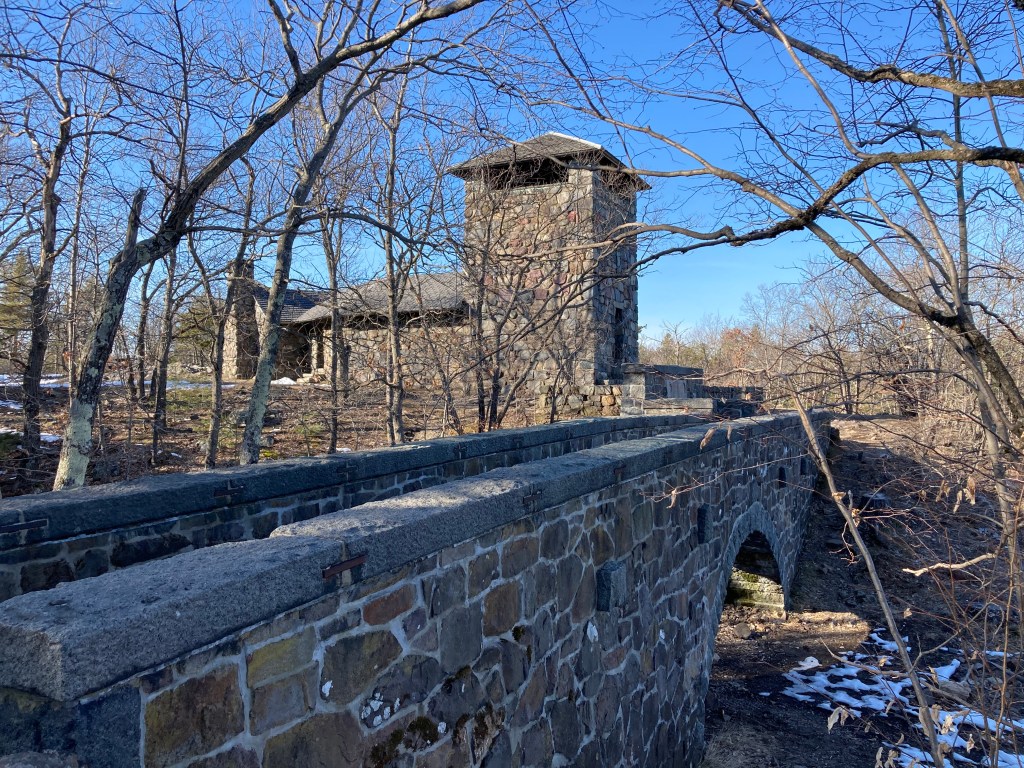
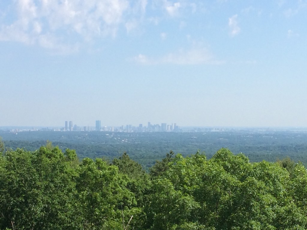
General info: Great Blue Hill rises to 635 feet (194 m) and is the highest of the 22 hills in the Blue Hills Reservation, a 7,000-acre state conservation area spanning Milton, Quincy, Braintree, Canton, Randolph, and Dedham. Located about 10 miles south of downtown Boston, it is the highest point in Norfolk County and in the Greater Boston area. In fact, Great Blue Hill is the highest coastal peak on the U.S. Atlantic seaboard south of Maine, giving it commanding views of the Boston skyline, Boston Harbor, and surrounding landscape on clear days. From the summit’s Eliot Observation Tower, visitors can enjoy a panoramic vista, spotting landmarks from the city skyscrapers to distant peaks like Mount Wachusett and even Mount Monadnock in New Hampshire on clear days. The Blue Hills Reservation is managed by the Massachusetts DCR and offers 125 miles of trails through forests, meadows, and wetlands. Hiking is extremely popular here. The reservation is a “green oasis” for outdoor recreation close to Boston. Trails are well-marked and range from easy woodland walks to some steep scrambles. The observatory, at the high point of Great Blue Hill, was established in 1885 by meteorologist Abbott Lawrence Rotch, continues to record weather data and houses historical weather instruments. In winter months, Great Blue Hill’s west slopes host the small Blue Hills Ski Area, with several ski trails and a chairlift for downhill skiing and snowboarding.
Historical background: Few hills in Massachusetts carry as much historical significance as Great Blue Hill. It inspired the name of the Massachusetts people and, by extension, the name of the Massachusetts Bay Colony—and, ultimately, the Commonwealth itself. There’s more to say historically about this hill than most.
Great Blue Hill and the Blue Hills range have been significant to humans for thousands of years. Indigenous peoples of the region, ancestors of the Massachusett tribe, lived on and around these hills for over 10,000 years. The very name “Massachusett” means “people of the great hill,” referring specifically to this landmark. Native communities used the Blue Hills as a source of stone for tools, and archaeologists have identified quarry sites where Indigenous people fashioned spear points and cutting tools from local stone. One of the oldest known archaeological sites in New England—the Ponkapaug site—lies near the southern foot of Great Blue Hill. This area remained an important village into the colonial period, inhabited by the Neponset tribe of the Massachusett people.
European explorers in the 1600s were struck by the hill’s bluish hue, caused by the mineral riebeckite in the granite, and named the range the “Blue Hills.” In the 17th and 18th centuries, English colonists cleared nearby forests for agriculture and timber. By the early 19th century, the region’s hard blue granite was quarried on a broader scale and used in building construction across Greater Boston.
By the mid-1800s, the summit of Great Blue Hill had become a destination for sightseers and scientists drawn by its elevation and coastal views. A turning point came in 1885, when meteorologist Abbott Lawrence Rotch constructed the Blue Hill Meteorological Observatory on the summit. Recognizing the hill’s ideal position for measuring atmospheric conditions, Rotch launched what became the country’s longest continuous climate record—one that continues to this day.
Just a few years later, in 1893, the Commonwealth of Massachusetts acquired Great Blue Hill and surrounding lands to form the new Blue Hills Reservation, one of the state’s earliest public parklands. Landscape architect Charles Eliot had championed the site for its scenic and recreational value, and the Metropolitan Parks Commission soon protected over 7,000 acres. Great Blue Hill became both the literal and symbolic high point of this park—a place where residents of the growing Boston area could reconnect with nature.
Throughout the 20th century, Great Blue Hill continued to be shaped by a balance of conservation and public use. In the 1930s, the Civilian Conservation Corps (CCC) operated a camp in the Blue Hills and built enduring infrastructure, including trails, picnic areas, and the Eliot Tower, a 35-foot stone lookout near the summit. They also constructed a similar tower on Chickatawbut Hill (the second highest in the Reservation) and carved ski runs into the side of Great Blue Hill, setting the stage for the Blue Hills Ski Area, which opened in 1950 and remains active in winter months.
In recognition of its scientific legacy, the Blue Hill Observatory was designated a National Historic Landmark in 1989. Today, Great Blue Hill remains the crown jewel of the Blue Hills Reservation—a place where thousands of years of human history and natural beauty continue to inspire those who walk its trails.
Recommended ascent routes:
Red Dot Trail: The most direct route to the summit, this steep trail begins behind the Blue Hills Trailside Museum on Canton Avenue. It climbs sharply over rocky terrain, crossing the paved summit road before reaching the Eliot Tower and observatory at the top. Expect a short but vigorous hike with rewarding views. The Red Dot trail then loops down the north side of the hill and back to the parking lot for a route of about 1.3 miles.
Summit Road: This paved service road offers a less rugged ascent of about 0.8 miles one-way from a gated access point off of Canton Avenue. While lacking trail atmosphere, it provides a steady uphill walk suitable for those avoiding rocky terrain. It’s also open to bicycles and popular for easier summit access.
Skyline Loop (from HQ): A more challenging and scenic option, this 3-mile loop starts at the Blue Hills Reservation headquarters on Hillside Street. The route follows the blue-blazed Skyline Trail over Hancock Hill, Hemenway Hill, and up to Great Blue Hill, then loops back via the southern extension of the Skyline Trail over Houghton Hill. Expect rocky footing, elevation changes, and excellent views. Total of about 800 feet in elevation gain.


Leave a comment