Mass 50 Public Peaks elevation rank: #47
Elevation: 1,686 feet
Prominence: 407 feet
Isolation: 2.11 miles
Summit coordinates: 42°17’54.3″N 72°59’44.5″W
Town: Chester, Massachusetts
Conservation Area: Gobble Mountain Preserve, The Nature Conservancy
Links:
Gobble Mountain on Peakbagger
Gobble Mountain on Listsof John
Gobble Mountain on AllTrails
Gobble Mountain Preserve website (The Nature Conservancy)
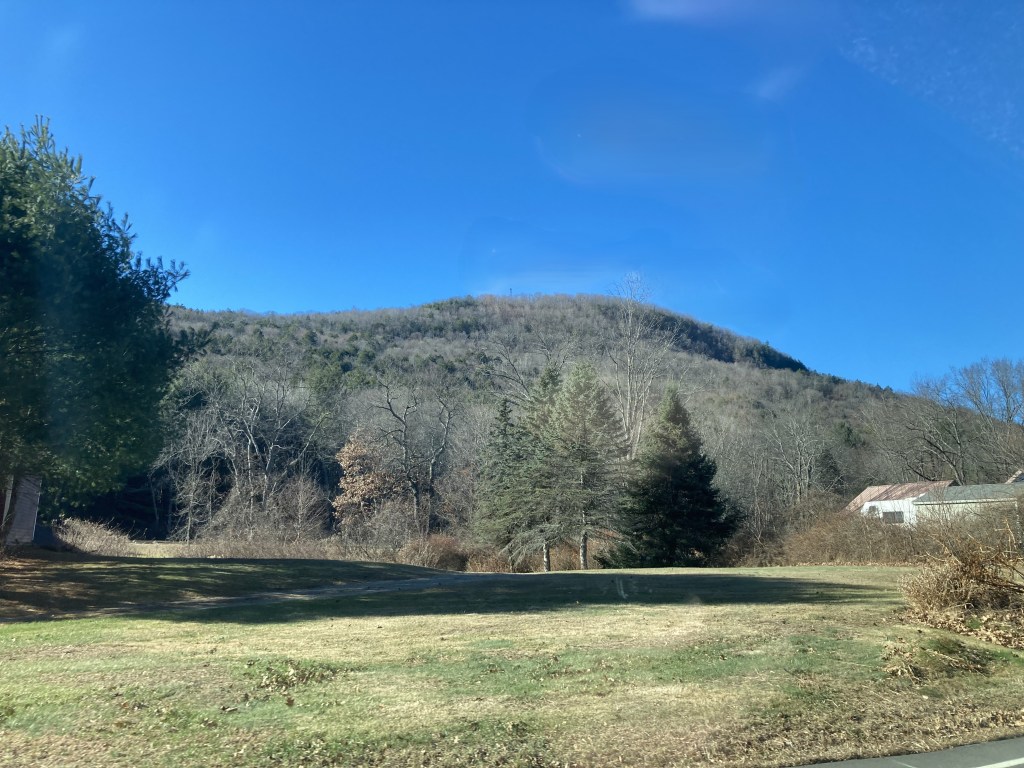
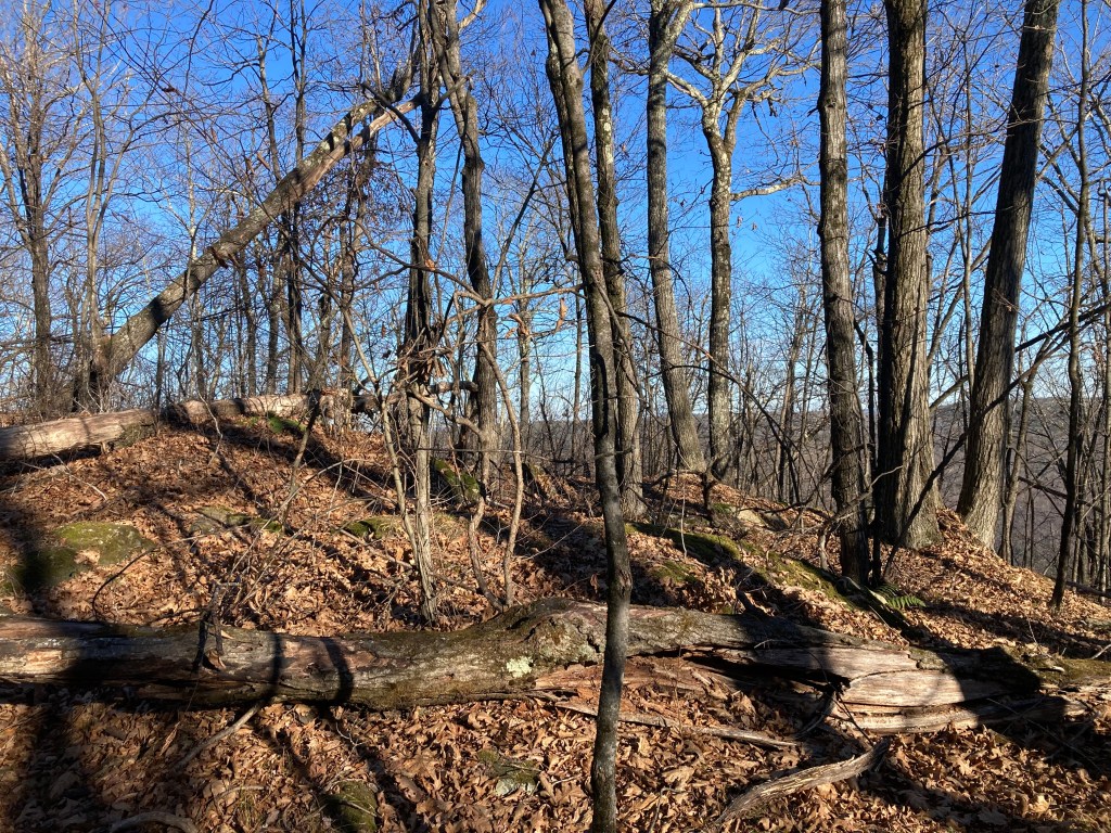
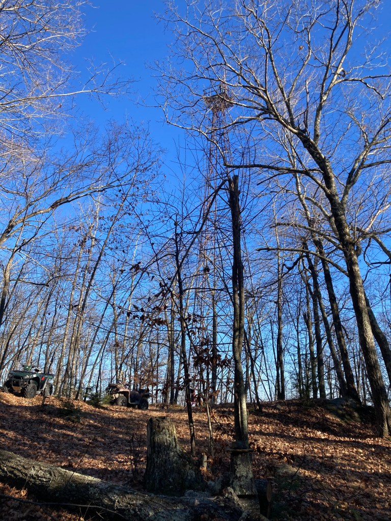
General info: Gobble Mountain rises steeply above the Westfield River valley in Chester, Massachusetts. Though modest in elevation, it feels much larger thanks to its rugged slopes, scattered ledges, and a wild, untamed character. The upper slopes are steep, rocky, and heavily wooded, offering a short but strenuous climb. I’ve read that there’s an overlook near the summit nicknamed “The Big View,” with a vista of Chester and the Westfield River, but I somehow missed it—perhaps it’s grown in, as many such vistas do, or maybe I simply missed the turn. The summit is marked by a rusting metal tower often mistaken for a fire tower, though it’s actually an old airway beacon that once guided early aviators at night (see below for more). The ladder is difficult to access, but trip reports suggest many have climbed it. When I reached the summit, two young men were perched up there for my entire snack break on a grassy patch below. Personally, I was content to keep my feet firmly on the ground—given its age, I wouldn’t try the climb (not to mention my own age!).
The Nature Conservancy’s Gobble Mountain Preserve, a 285-acre tract acquired in 2004, is open to the public year-round, with no fees or facilities. Trails are lightly maintained but accessible. Parking at the trailhead can be a bit tricky: the small pull-off fits only one or two cars in a line, and I was a bit concerned about getting blocked in. Roadside parking isn’t really an option, as the shoulder drops off steeply into a ditch. It’s not ideal, but manageable.
Historical background: While the origin of the name “Gobble Mountain” isn’t definitively recorded, it likely refers to the wild turkeys that once thrived in this area (and have recently made quite a comeback). The land surrounding Gobble Mountain was traditionally part of the territory of Mahican-speaking peoples, who traveled the Westfield River corridor for fishing, foraging, and seasonal hunting. Though the steep uplands were likely too rugged for sustained settlement, the peak would have been familiar to Indigenous people moving through the region.
European settlers arrived in Chester in the mid-1700s, and by the early 1800s, farmers had cleared much of the gentler lower slopes. Stone walls still found in the forest hint at these long-abandoned pastures and I saw the remnants of at least one stone foundation along the trail. The farms were modest and often short-lived. As industrial activity shifted to the valley—especially with the arrival of the Western Railroad in 1841—these hilltop farms were gradually abandoned and reclaimed by forest.
Gobble Mountain also has a lesser-known industrial past. In the late 1800s, it hosted a small emery mine, part of Chester’s once-prominent abrasive mineral industry. Emery, a hard rock used in metal polishing, was discovered in the area in 1864. Though the Gobble site was minor compared to other Chester mines, it remains a point of historical interest.
The most visible historic feature today is the airway beacon, a rusting steel frame at the summit. In the 1930s, the federal government installed rotating beacons on high ridges to help guide early airmail and commercial flights. Gobble Mountain’s summit was chosen as one such site, and for decades its tower helped mark the Springfield–Albany corridor. The light was extinguished long ago, but the structure still stands—an imposing landmark among the trees.
Recommended ascent routes: The standard route up Gobble Mountain is the Beacon Trail, which begins across from the old Chester Elementary School on Middlefield Road (Route 20A). There’s a small pull-off near a break in the guardrail—easy to miss. This route is roughly 2.5 miles round-trip with an elevation gain of about 1,000 feet. Short and steep. There is another route that appears to be popular with ATV drivers that climbs Gobble from the west along on old mining or logging road. The Beacon Trail intersects it near the summit. But part of this ATV route crosses private land and I don’t recommend it.
Nearby Listed Peaks: Gobble Mountain pairs naturally with Round Top Hill, just 2 miles to the south in Chester. Round Top is slightly taller, with similar prominence, and also features a short hike with partial views and wooded summit clearings. From Gobble, you’re also within 30–45 minutes of several other Massachusetts 50 Highest summits including Walling Mountain, located in Becket, accessible from October Mountain State Forest or the Appalachian Trail corridor, Warner Hill, a mellow hike from the AT near Hinsdale, known for its open summit ledges and wide views, and Tully Mountain, a bit further out on the AT north of Warner Hill.
Back to Massachusetts 50 Highest Public Peaks list
Click photos to enlarge:

Leave a comment