Mass 50 Public Peaks elevation rank: #45
Elevation: 1,774 feet
Prominence: 286 feet
Isolation: 1.37 miles
Summit coordinates: 42° 39′ 53” N, 72° 56′ 45” W
Town: Rowe, Massachusetts
Conservation Area: ISO Hydroelectric property (open to public recreation)
Links:
Negus Mountain on Peakbagger
Negus Mountain on Listsof John
Negus Mountain on AllTrails
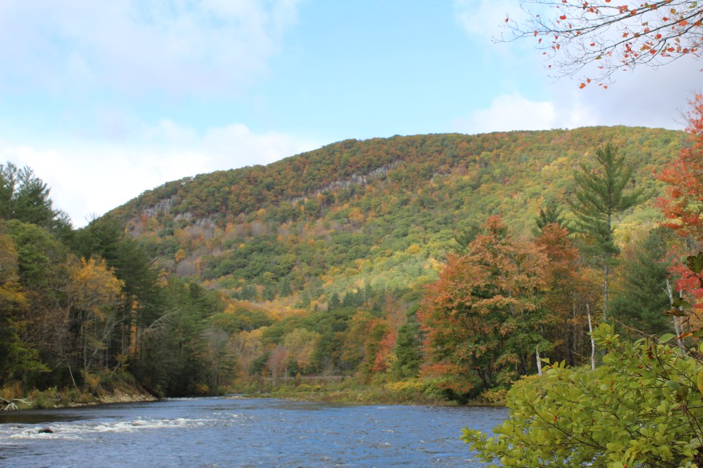
General info: Negus Mountain (pronounced “nee-gus”) may be modest in elevation, but it packs an outsized punch. Surrounded on three sides by the deep gorge of the Deerfield River, its slopes plunge toward the valley floor at strikingly steep angles. The ascent involves rugged, rocky scrambles—rare for Massachusetts—and feels more like a hike in the White Mountains than in the Berkshires. This unexpected terrain creates some of the most dramatic scenery in western Massachusetts. For all these reasons, Negus Mountain might just be my favorite peak in the state—perhaps second only to the mighty Greylock.
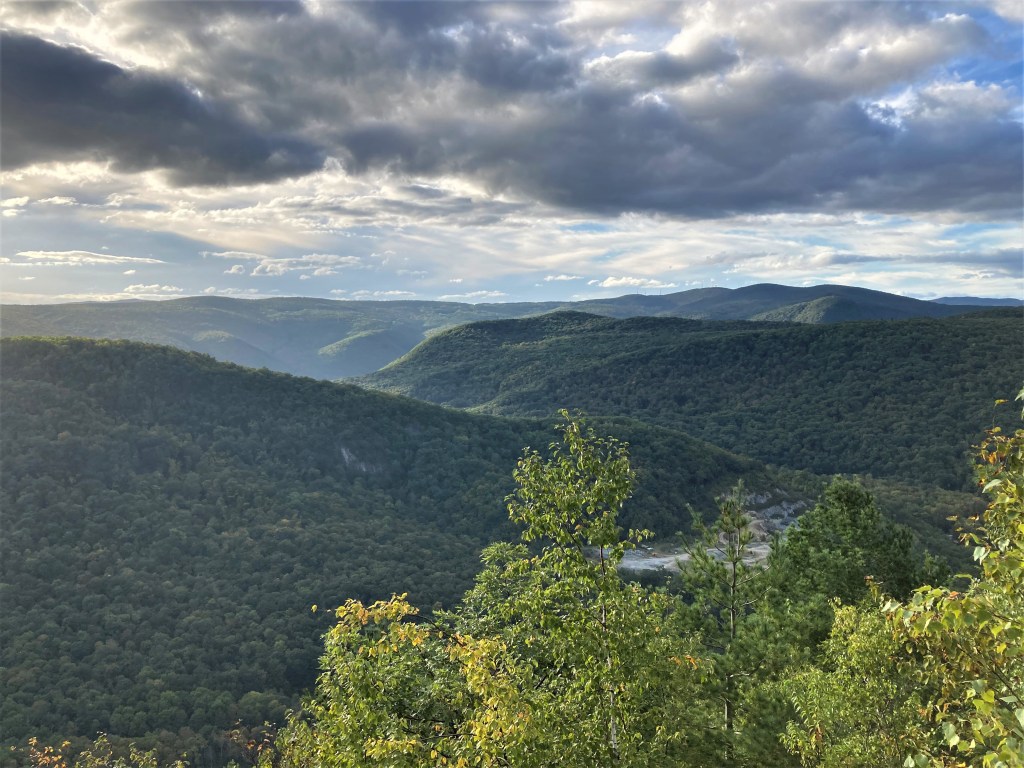
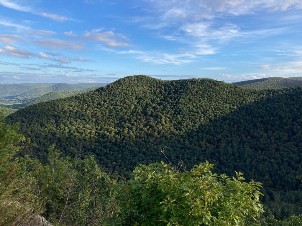
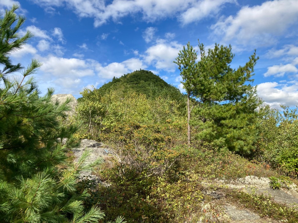
From the very start, the ascent of Negus is steep, gaining several hundred feet in the first quarter mile. At points the grade approaches a 60% slope. Partway up, the trail breaks out onto a series of south-facing ledges with incredible views of the Deerfield River Gorge, also known as the “Zoar Gap”, looking across at Todd and Clark Mountains, and west to the larger peaks of the northern Berkshires and Taconics. The summit of Negus Mountain itself is mostly wooded with a bit of a clearing providing a view westward. There are no buildings, towers, or cairns at the top. The actual highpoint lies a few yards off the east side of the side, indicated only by natural high ground, no markers.
Overall, Negus Mountain offers a short but vigorous climb through wild terrain, capped with surprising vistas that far exceed what one might expect from a sub-2000-foot hill in Massachusetts.
Historical background: The word “Negus” has ancient roots—it was once a title for Ethiopian kings and used in the Bible. It’s possible the word may have been borrowed by settlers who favored biblical names (as seen in the village of Zoar at the foot of Negus Mountain). It seems more likely, however, that the mountain was not named for biblical kings but rather for a local family. The surname “Negus” appears in 19th-century Rowe town records, including an Amos Negus. Several nearby mountains (including Todd, Hawks, Clark, and Adams) are named for local families who owned property on those mountains, and such is likely the case for Negus.
Long before colonists arrived, the mountain stood in land used seasonally by Indigenous peoples—including the Mahican, Mohawk, and Pocumtuck. The Deerfield River, flowing just below Negus’s slopes, served as an important travel corridor for fishing and trade. European settlers surveyed and purchased Rowe’s lands in 1762, and the town was incorporated in 1785. As settlers cleared farmland in the hollows and hills, Negus Mountain would have remained a forested backdrop—untamed and steep.
By the mid-1800s, parts of the mountain were deforested. Hill farmers cleared upper slopes for sheep pasture, and period photographs even show grazing flocks on what was then an open summit. During this time, the peak earned the nickname “Old Smokey” due to the frequent brush fires that swept its dry slopes—often sparked by steam locomotives that ran along the railroad partly encircling the base of Negus Mountain. With the 1875 completion of the Hoosac Tunnel and the arrival of the railroad in the Deerfield River valley, Negus became a dramatic landmark for travelers and picnickers. But by the early 20th century, the farms were abandoned, the mills closed, and the forest reclaimed the peak.
In the 1970s, Negus Mountain became host to the Bear Swamp Pumped Storage Station, a hydroelectric facility built into the mountain’s bedrock. The northern side of the summit plateau was reshaped to hold the Upper Bear Swamp Reservoir, a 1,600-foot-high artificial lake. Though industrial in purpose, the project indirectly benefitted hikers as it created open rights of way and, in recent years, a formal hiking trail has been blazed across the mountain’s southwest ridge. Today, much of Negus is accessible to hikers, with trail maintenance supported by the hydro company. Events like the Rowe Historical Society’s 2022 “History Hike” reflect a renewed appreciation for the mountain’s layered past—from Indigenous land to pasture, from “Old Smokey” to wild summit once again.
Recommended ascent routes: The best way to hike Negus Mountain is via the Bear Swamp Trail from the southwest, starting near Zoar Road in Charlemont. I recommend parking at the Zoar Picnic Area just east of the bridge where there is lots of parking as well as picnic tables, port-a-johns, and an interesting, old family cemetery plot. Cross the road and walk a bit towards the bridge and you’ll see a small dirt access road to the right. After carefully crossing the active train tracks, follow the blue-blazed Bear Swamp Trail, marked with bear paw logos. The trail ascends steeply up the mountain’s southwest ridge, gaining nearly 1,000 feet in just 1.5 miles. I took this route out to the summit and back, about 3 miles and 1,150 feet in elevation gain total.
There is a northern approach that I haven’t tried from Tunnel Road which follows an old jeep road with a more gradual grade—easier but without the ledge views. And for a full-day hike, the point-to-point traverse along the entire Bear Swamp Trail from Zoar to Monroe Bridge (7.5–8 miles) offers a scenic mix of forest trail and ridgeline, though parking logistics at the north end would be tricky.
Nearby Listed Peaks: Negus Mountain is part of a cluster of high peaks in the northern Berkshires and upper Franklin County. For hikers working on the “Massachusetts 50 Highest Public Peaks” list, there are numerous summits very nearby that are quite rewarding. Adams Mountain (2,096′) lies within Pelham Lake Park in Rowe, approximately 3 miles from Negus. Trails through oak and pine forests lead to its wooded summit. Todd Mountain (1,698′) is located in Charlemont within the Mohawk Trail State Forest. Accessible via the Mahican-Mohawk Trail, the hike to its summit involves a steep ascent with approximately 1,030 feet of elevation gain. Clark Mountain (1,923′) is situated about 5–6 miles south of Negus in the town of Florida. It lies within the Mohawk Trail State Forest and is typically approached from the campground on Route 2. Spruce Mountain (2,717′), located northwest of Negus in Monroe, is one of the highest peaks on the list. It resides within Monroe State Forest and features a 6.5-mile loop trail that includes the Raycroft Overlook, providing outstanding vistas of the Deerfield River gorge and surrounding wilderness. Together, Negus, Adams, Todd, Clark, and Spruce form a rewarding circuit of off-the-beaten-path peaks—all within a short drive.
Back to Massachusetts 50 Highest Public Peaks list
Click photos to enlarge:

Leave a comment