Mass 50 Public Peaks elevation rank: #49
Elevation: 1,619 feet
Prominence: 684 feet
Isolation: 9.8 miles
Summit coordinates: 42°41’28.5″N 72°21’17.7″W
Town: Warwick, Massachusetts
Conservation Area: Mount Grace State Forest
Links:
Mount Grace on Peakbagger
Mount Grace on Listsof John
Mount Grace State Forest on AllTrails
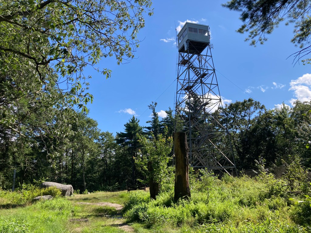
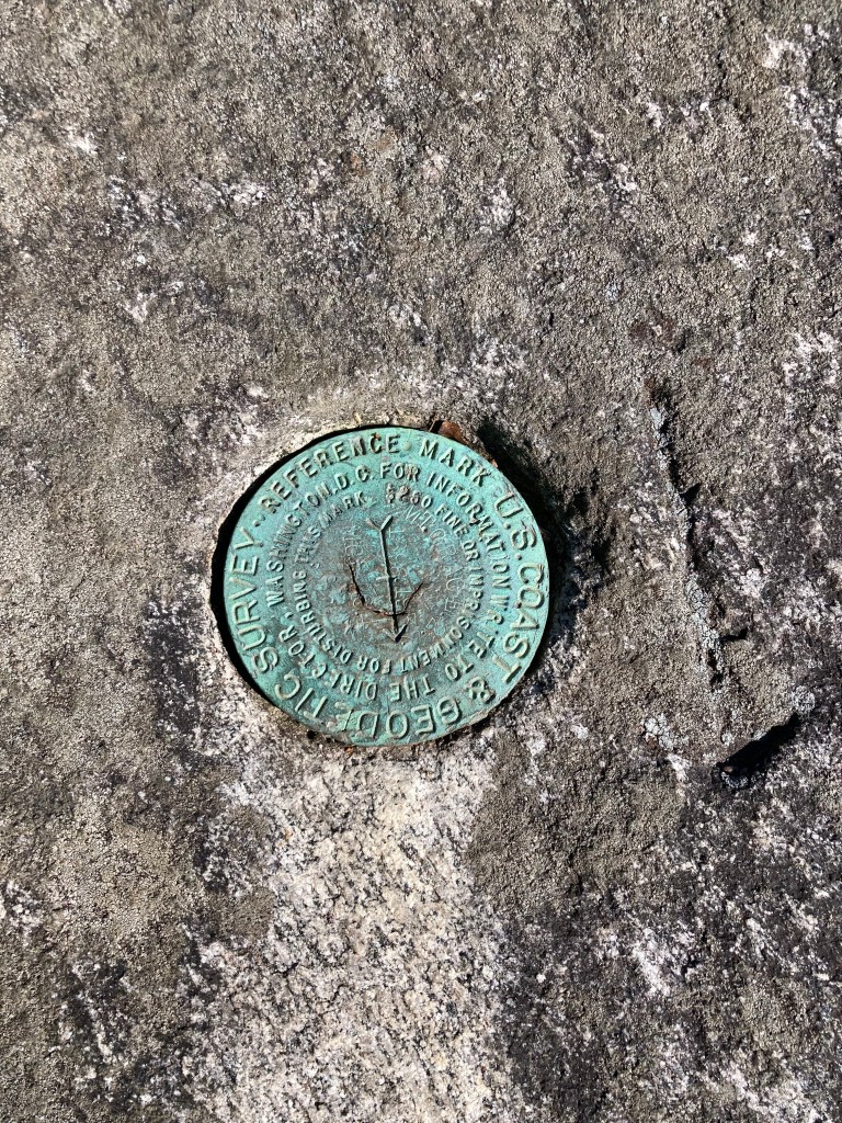
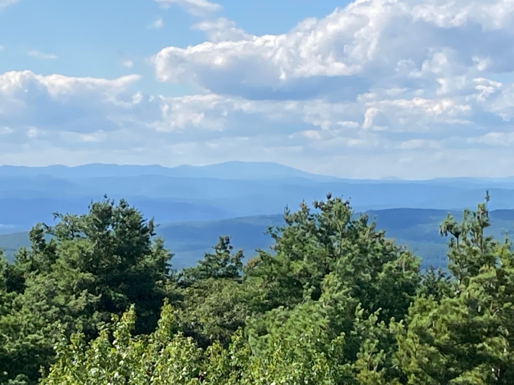
General info: Mount Grace is a prominent monadnock in north-central Massachusetts, just two miles south of the New Hampshire line. Heavily wooded and rising well above the surrounding hills, it is the third-highest point in Massachusetts east of the Connecticut River (after Mount Wachusett and Mount Watatic). The mountain is part of the nearly 1,600-acre Mount Grace State Forest and features a network of multi-use trails. Atop the summit stands the Warwick Fire Tower, a 68-foot steel lookout tower built in 1939, which is open to climb and offers amazing 360° views. From the top you can see landmarks like Mount Monadnock to the northeast and Mount Snow on the northwestern horizon. On the ground, the summit has a small grassy area with picnic spots and a USGS survey marker, but no natural vistas – the fire tower is key to getting the view. Mount Grace’s trails are moderately popular with hikers yet far quieter than touristy peaks; you might have the tower to yourself on a weekday. The mountain’s extensive state-owned land and the presence of the New England Trail (NET, formerly the Metacomet-Monadnock Trail) crossing its summit make it a significant recreational hub in this rural area. Yet despite its accessibility, Mount Grace retains a remote feel.
Historical background: The name “Mount Grace” originates from a legend tied to Mary Rowlandson, a Puritan woman captured during King Philip’s War (1676). According to local lore, Rowlandson’s infant daughter (referred to as “Grace”) died during the forced march north and was buried near this mountain, which was then named in her memory. In truth, Mary Rowlandson’s daughter was named Sarah, and she died elsewhere, but the poignant story has persisted as folklore. Long before this colonial naming, the region was inhabited by Native peoples (Nipmuc or related Algonquian tribes) who utilized these forests and hills, though specific indigenous names for Mount Grace have not survived.
By the late 19th century, Mount Grace had been largely deforested by logging and farming, like most New England peaks. In 1920, prompted by local conservationist Dr. Paul Goldsbury of Warwick, the Commonwealth purchased the mountain and surrounding lands to establish a state forest. During the 1930s the Civilian Conservation Corps (CCC) built recreational amenities here, including picnic grounds, trails, and a 4.7-mile snowshoe trail encircling the mountain, A small downhill ski area operated on Mount Grace’s eastern slope mid-20th century – hikers can still find rusting pulleys and engine parts from the old rope tow hidden beside the trail near the base.
The first fire lookout on Mount Grace was erected in 1911, a 40-foot iron tower with a ladder. It was replaced in 1920 by a 68-foot steel tower that was famously blown down in the great Hurricane of 1938. The current Warwick Fire Tower was built in 1939 and, after a thorough rehabilitation in 2010, remains an active fire lookout to this day. (It is typically staffed in spring and fall during high fire danger periods.) Thanks to state and local stewardship, the mountain’s forests have regenerated, and public access has been secured for future generations.
Recommended ascent routes: There is a recreation area on the eastern side of Mount Grace (picnic tables, soccer field, etc.) with lots of public parking off of Winchester Road (Route 78). From here, you can embark on the “Long Loop” which will take you up the mountain and around most of the conservation area (this is the loop I took and I recommend it), or the short loop essentially up to the summit and directly back.
Mount Grace Long Loop–This route covers 4 miles and about 1,130 feet of elevation gain. It will take you to the summit, then through some very pleasant forest. It passes by the interesting rusty remains of the old ski area rope tow.
Mount Grace Short Loop–Despite its name on AllTrails, this route is actually an “out-and-back” covering 2.6 miles and about 750 feet elevation gain to the summit and back to the parking area.
Nearby Listed Peaks: Hikers pursuing the “Mass 50 Highest Public Peaks” will find Mount Grace to be geographically isolated from the clusters of higher Berkshire peaks, but it serves as a great excuse to explore this quieter part of the state. To the east, about an hour’s drive away, Mount Watatic (#42 on the Mass 50 list) straddles the MA/NH line and is another popular hike with excellent views. Watatic (1,832′) and Wachusett are the only Massachusetts peaks east of the Connecticut River taller than Mount Grace. To the west, in Franklin County, the closest listed peak is Massaemett Mountain (#50) in Shelburne. Massaemett (1,593′) also features a historic fire tower and overlooks the Deerfield River valley; it lies roughly 25 miles west of Mount Grace (about a 40 minute drive). Those looking to extend their outing near Mount Grace can also explore other trails in the area, such as the nearby Tully Trail network around Tully Mountain and Tully Lake (not on the 50 Highest list but a local favorite), or even venture north into New Hampshire for a climb up Mount Monadnock, which looms on the horizon from the Mount Grace fire tower.
Back to Massachusetts 50 Highest Public Peaks list
Click photos to enlarge:


Leave a comment