Mass 50 Public Peaks elevation rank: #43
Elevation: 1,826 feet
Prominence: 340 feet
Isolation: 1.04 miles
Summit coordinates: 42°11’08.3″N 73°10’57.0″W
Town: Monterey, Massachusetts
Conservation Area: Beartown State Forest
Links:
Hunger Mountain on Peakbagger
Hunger Mountain on Listsof John
Hunger Mountain on Alltrails
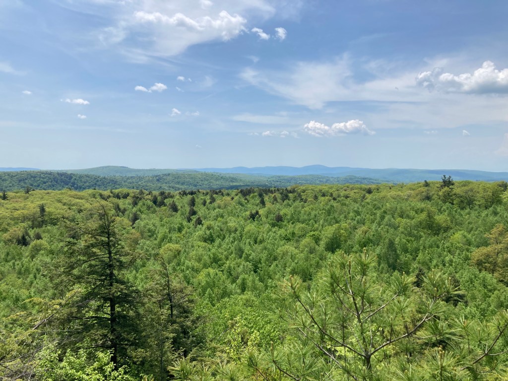
General info: Hunger Mountain is a lesser-known peak in the southwestern Berkshires of Massachusetts. Its elevation is modest but towards the peak its sudden steepness provide a nice workout. And although it’s not the higest peak in the Berkshires, this “cobble” (a local term for a small rocky hill) rewards hikers with surprisingly expansive views. The mountain sits on the Konkapot Ridge, a high plateau area between the Tyringham Valley and Lake Garfield. From its open ledges, you can gaze west toward the Taconic Range (the Taconic Crest is visible on the horizon) and even spot the distant Catskill Mountains on a clear day. The hike is short and relatively easy, making Hunger Mountain a great stop for those pursuing the Massachusetts 50 Highest list or anyone looking for a quick scenic outing away from crowds. The terrain features mossy forests and interesting quartzite rock outcrops at the summit (the Monterey Cobbles), remnants of ancient bedrock that add geologic interest to the walk. Overall, it’s a quiet, somewhat off-the-beaten-path peak that offers a big payoff for minimal effort.
Historical background: The origin of the name “Hunger Mountain” is not well documented, but such names in New England often hark back to early settler experiences with scarcity or poor farming conditions. This area was originally part of the homeland of the Mohican people, who called the Berkshires home before European settlement. In the 1700s, Mohican leader Captain John Konkapot was involved in land transactions here as English colonists moved in. By 1730, local settlers (such as the Dowd family of Monterey lore) had acquired land from the natives. During the colonial period, the lower slopes of Hunger Mountain were cleared for sheep and dairy farming; stone walls and even a small Mount Hunger Cemetery (est. 1774) can still be found, hidden in the regrown forest. No notable structures ever crowned the summit (unlike some taller peaks, it never had a fire tower or ski area), but the mountain’s forests saw periodic logging through the 20th century. In recent years, conservation efforts by the Massachusetts DCR and the Berkshire Natural Resources Council have ensured the mountain and surrounding land remain protected. Hunger Mountain now forms part of a DCR-managed Beartown State Forest parcel, and in the 2020s BNRC established the Mount Hunger Reserve (Konkapot Ridge) with improved trails, preserving the mountain’s natural state for future hikers.

Recommended ascent routes: This small conservation area has a single loop. I would recommend approaching it clockwise. This allows for a more gradual ascent. The approach going counter-clockwise is steep for the very short ascent, which is fun, but I preferred the longer approach, getting a feel for the area and its many stone walls.
Hunger Mountain and Monterey Cobbles Trail–This is the loop on AllTrails. There is a small parking area for maybe two cars off of Hupi Road. The route is just 2 miles and 350 feet in elevation gain. Note that the northernmost part of this trail is prone to flooding (there is a beaver pond north of Hunger Mountain and the beavers have been industrious). I had to bushwhack to make my way around the flooded pond but eventually found my way back to the trail. I was surprised by the fine view from the top of this little mountain.
Nearby Listed Peaks: There are no other Massachusetts 50 Highest summits immediately adjacent to Hunger Mountain, so you won’t be bagging multiple peaks in one hike here. The nearest on the list is Mount Wilcox to the east, which lies along the Appalachian Trail in Beartown State Forest (a separate hike, a few miles away). A short drive north will bring you to Lenox Mountain, and heading south you can tackle higher peaks like Mount Everett and Mount Race in the Taconic Range. These peaks are all part of the Massachusetts 50 Highest Public Peaks challenge and offer their own unique views and trails. While in the Monterey/Tyringham area, casual hikers might also enjoy the scenic Tyringham Cobble (a lower but beautiful hill managed by Trustees of Reservations) as a bonus stop.

Leave a comment