Mass 50 Public Peaks rank: #46
Elevation: 1,698 feet
Prominence: 237 feet
Isolation: 0.73 miles
Summit coordinates: 42° 38′ 50” N, 72° 56′ 33” W
Town: Charlemont, Massachusetts
Conservation Area: Mohawk Trail State Forest
Links:
Todd Mountain on Peakbagger
Todd Mountain on Listsof John
Mohawk Trail State Forest on Alltrails
Mohawk Trail State Forest website (including trail map)
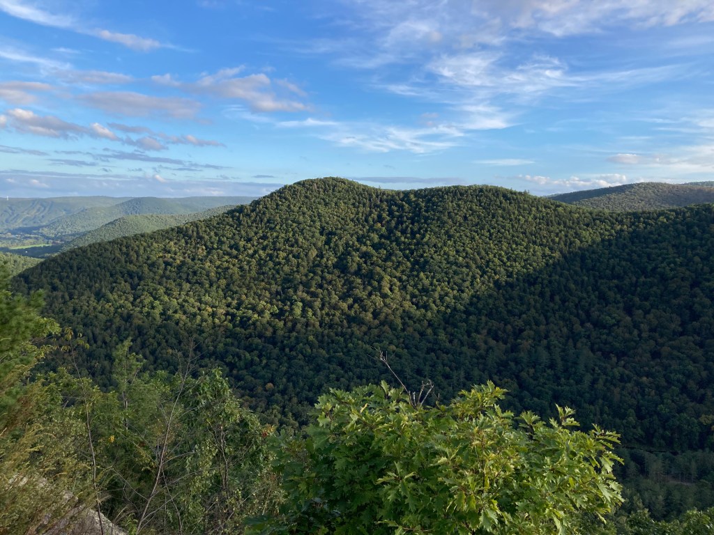
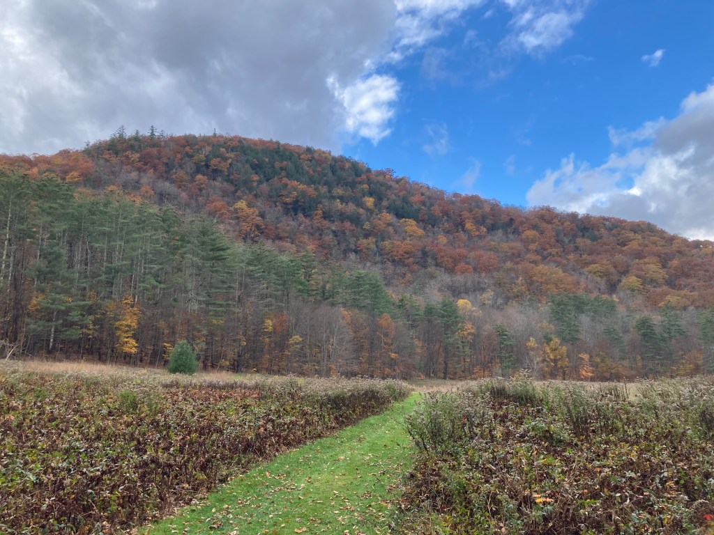
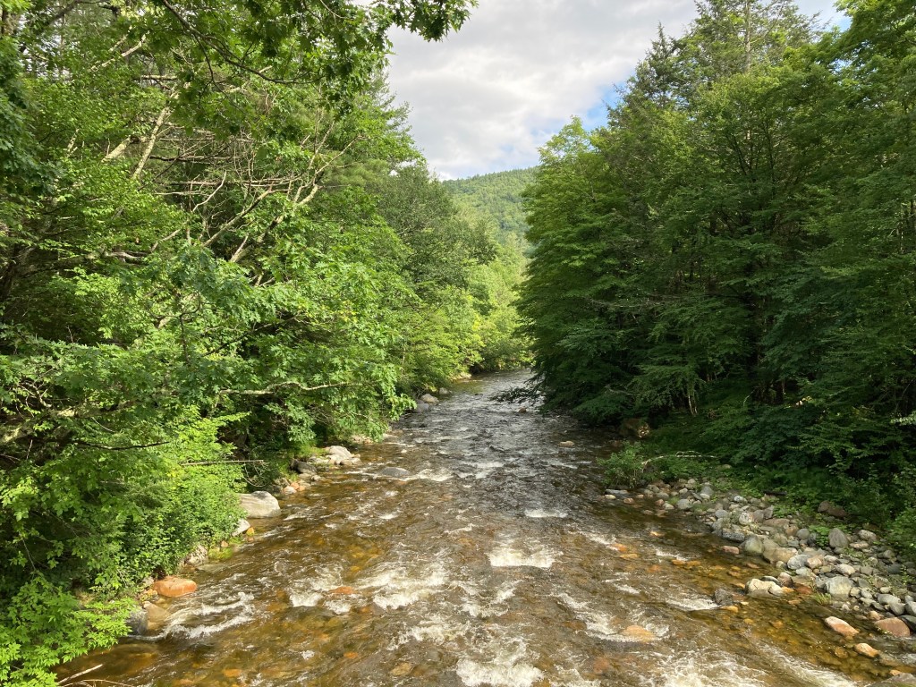
General info: Todd Mountain (not to be confused with nearby Todd Mountain in Rowe) is one of my favorite peaks in Massachusetts. Despite its lower elevation ranking, don’t underestimate this climb. With the steep Cold River Gorge on one side and the Deerfield River Gorge on the other, a hike up Todd Mountain is a workout. The rugged, heavily wooded slopes make for beautiful scenery, and while there are no vast panoramic vistas, a small clearing at the summit provides an impressive view to the south and west over the Cold River Gorge. All this, plus its fascinating history and historical ruins, an excellent network of state park trails including the historic Mahican-Mohawk Trail, and the fact that the surrounding forest is known for stands of old-growth trees and some of the tallest white pines in New England—well, I think of it as a sort of playground. One route to the summit (the Mahican-Mohawk Trail) follows the Deerfield River for a considerable stretch. Along the river, with steep hills on either side, you’ll find some of the best scenery in New England, particularly in the fall.
Historical Background: This will be a longer post than usual as Todd Mountain and its environs are steeped in history, both indigenous and colonial. For centuries Native American tribes (including the Mohawk, Mahican, and Pocumtuck peoples) used the route across these hills as a travel and trade corridor between the Hudson and Connecticut River valleys. The ridgeline connecting Todd and neighboring peaks was likely part of this ancient footpath known as the Mohawk Trail, long before any road existed. It began as a pre-colonial trade route linking Atlantic coast tribes with those in upstate New York. In the colonial era, European settlers also traversed this area, and by the early 20th century, much of the path evolved into a paved road (Massachusetts Route 2) famously designated as New England’s first scenic auto route in 1914. Some sections of the ancient path, particularly those in rugged areas, remained in their original state and it is believed that a section of the old Mohawk Trail runs up and across the ridge of Todd Mountain. The modern Mahican-Mohawk Trail was initiated in 1992 when a group of Williams College students researched the history and path of the original Native American trail, assessing opportunities for its reestablishment. This effort led to the reclamation of portions of the trail for recreational use, about 40 miles including several miles up and along Todd Mountain.
By the 19th century, a small village had formed at the confluence of the Deerfield and Cold Rivers with a sawmill, a schoolhouse, and several farms. All these buildings were removed in the 1920s after the state established Mohawk Trail State Forest in 1921, but the foundations of some of the buildings can be seen, as well as evidence of formerly tilled fields and plenty of old stone walls. Perhaps the most striking evidence of Anglo settlement here is the lonely double-grave marker of John and Susannah Walker, located on land that once was their farm—now woodland near the Deerfield River. John was a veteran of the Revolutionary War.
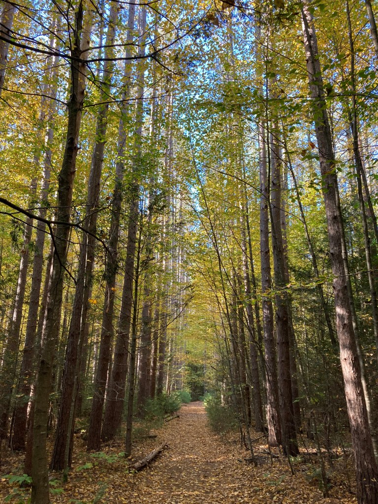
During the 1930s, the Civilian Conservation Corps (CCC) built facilities and trails in the forest, including campsites and cabins that are still in use. Past land uses around Todd Mountain included small-scale farming and logging in the valleys, but much of the mountain’s steep terrain remained wild. This allowed pockets of ancient forest to persist; today the state forest harbors trees over 300–500 years old. These include extremely tall stands of second-growth white pines. One of them, named Jake Swamp, is the tallest in New England at roughly 176 feet. Conservation efforts have ensured that old-growth stands and significant wildlife habitat around Todd Mountain are preserved for future generations. Hikers on Todd’s trails can thus appreciate not only the views but also the rich natural and historical context—from walking in the footsteps of Native travelers to enjoying a landscape largely unchanged since the CCC’s reforestation efforts.
Recommended ascent routes: There are many great ways to get to the top of Todd Mountain. Listed below are three of the best. Note that there is plenty of parking at the State Park entrance on Route 2, but hikers are asked to park at the roadside parking area and not across the bridge. The other side of the bridge is for campers and state vehicles only.
Mahican-Mohawk Trail to Indian Trail Lookout–This beautiful route will take you along the Deerfield River at the eastern edge of the park and then up the Mahican-Mohawk Trail to the summit. Along the river, you’ll pass through the remains of the farms and meadows. 6.4 miles and about 1,500 feet in elevation gain
Todd Mountain Lookout via the Indian Trail–This is a short but extremely steep route that goes right up the face of the Cold River Gorge. As mapped here, it calls for a return trip via the same route for a short 1.5 miles and about 900 feet of elevation gain. But I would recommend extending this by descending on the north side via the Mahican-Mohawk Trail and enjoying the old woods and meadows on the north and east sides of Todd Mountain.
Elder Grove Trail to Todd Mountain–This route starts across the river at the Zoar Recreation Area, a picnic area that has plenty of public parking. Cross the nearby road bridge to access the Mohawk Trail State Forest. This route will take you through some of the very tall stands of white pines. About 4.8 miles and 1,400 feet in elevation gain.
Nearby listed peaks: Clark Mountain is adjacent to Todd and can be paired easily enough. The Mahican-Mohawk Trail runs directly west to Clark from Todd Mountain. Negus Mountain is just across the Deerfield and if you’ve got more steam than I do, both might be hiked in one go (but they are both very steep and that’s more than I could do). Massaemett Mountain is a short drive to the east in Shelburne Falls. And, of course, Mount Greylock and its many subpeaks are a short drive to the west.
Click photos to enlarge:


Leave a comment