Mass Public Peaks rank: #30
Elevation: 2,072 feet
Prominence: 559 feet
Isolation: 3.93 miles
Summit coordinates: 42° 25′ 16” N, 73° 22′ 47” W
Town: Richmond, Massachusetts
Conservation Area: Hollow Fields Reserve (Berkshire Natural Resources Council)
Links:
Perry Peak on Peakbagger
Perry Peak on ListsofJohn
Hollow Fields website (BNRC)
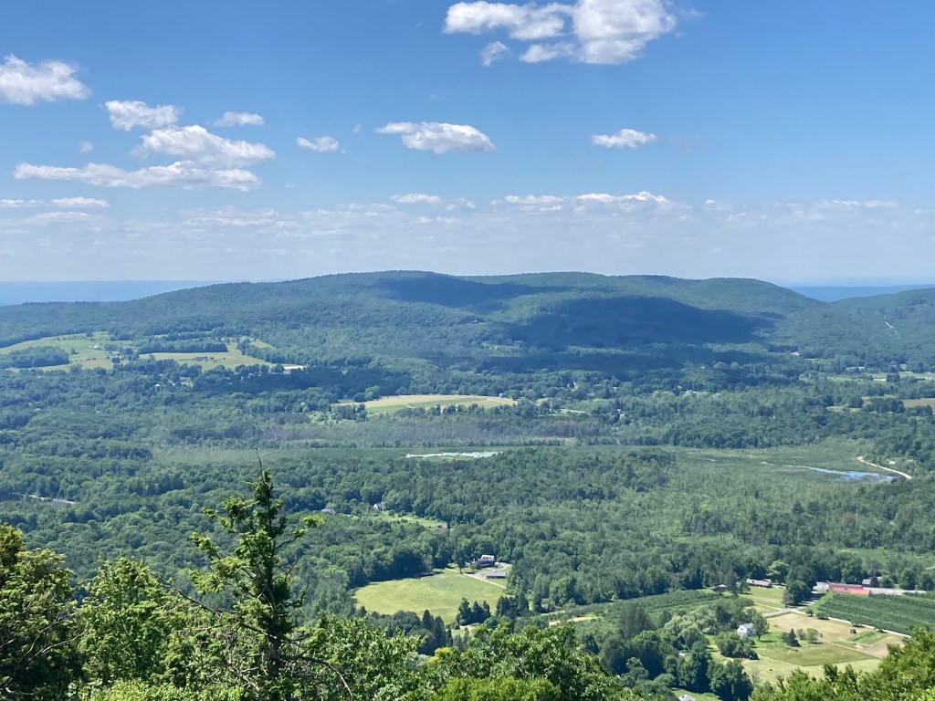
General info: Perry Peak is the highest point in the town of Richmond, Massachusetts. This peak sits towards the southwest corner of the state, close to the New York border, and is part of the Taconic Mountains. The mountain lies with the Hollow Fields Reserve of the Berkshire Natural Resources Council. The Reserve, encompasses over 660 acres of hayfields and forests in Richmond. The vast hayfields at the foot of Perry Peak offer some stunning views of Yokun’s Ridge in Lenox. The summit of Perry Peak is wooded but allows some partial views of the surrounding Taconic range. There is a fine overlook just south of the summit known as Richmond Overlook.
Historical background: The Perry family played a prominent role in Richmond’s early history, contributing as reverends, doctors, town officials, and local militia officers. However, the exact namesake of Perry Peak remains unclear. A portion of the Hollow Fields Reserve, named after the Sleepy Hollow Brook that flows through it, was once owned by the Shakers, whose nearby settlement in Hancock is now a museum. Other sections of the reserve were preserved through generous donations, including the Shaw family’s gift of the southern and western hayfields and the Miller family’s contribution of land, originally donated to the town of Richmond, that became part of the reserve. The Miller family were former owners of The Berkshire Eagle. Additional acquisitions by the Berkshire Natural Resources Council in 2016 and 2019 further expanded the reserve, ensuring its protection for future generations.
Recommended ascent routes: Perry Peak can be approached from the north via Bates Memorial State Park (parking available on Route 20 in Hancock) or from the southeast via the Hollow Field Reserve. I have not tried the former. The latter was quite beautiful and recommended.
Perry Peak via Hollow Fields: The link will take you to my route. There is plenty of parking at the BNRC lot on Perry Peak Road. The first part of the hike travels through beautiful, wide-open hayfields. The trails throughout this area were in excellent condition. Don’t miss Richmond Overlook (I stopped by on my way down and enjoyed lunch there). In all about 4 miles and 800 feet of elevation gain.
Nearby Mass 50 Highest Public Peaks: Perry Peak lies just to the south of Pittsfield State Forest which contains seven summits listed on the Mass 50 Highest Public Peaks. The nearest to Perry Peak are Holy Mount and Shaker Mountain. Depending on how ambitious you’re feeling, all three could theoretically be included in a day hike, though it would be a long one.
Click photos to enlarge:


Leave a comment