Mass Public Peaks rank: #36
Elevation: 1,923 feet
Prominence: 275 feet
Isolation: 1.4 miles
Summit coordinates: 42°38’48.6″N 72°57’55.9″W
Town: Florida, Massachusetts
Conservation Area: Mohawk Trail State Forest
Links:
Clark Mountain on Peakbagger
Clark Mountain on ListsofJohn
Mohawk Trail State Forest website (including trail map)
Mohawk Trail State Forest on Alltrails
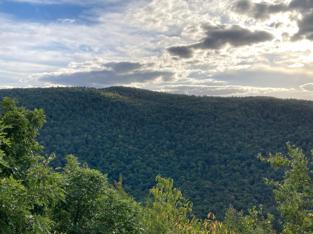
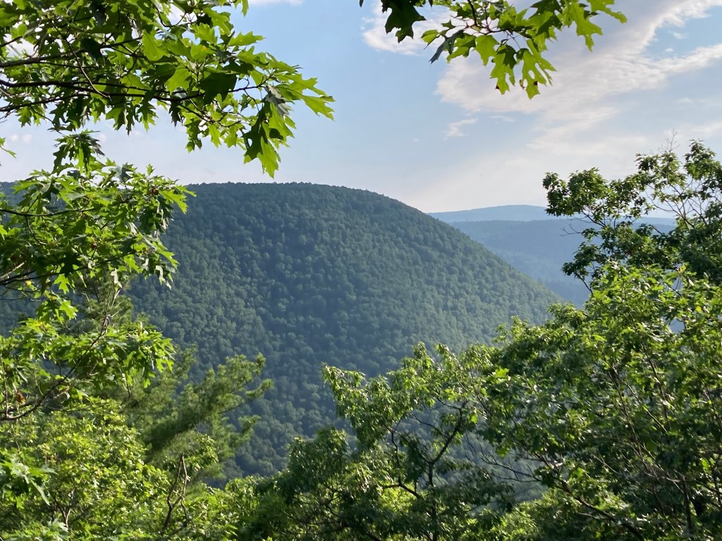
General info: Clark Mountain is a notable peak within the Mohawk Trail State Forest in Florida, Massachusetts. The mountain is part of the Todd-Clark Mountain ridge, which is traversed by the Mahican-Mohawk Trail—a historic route recreating the ancient Native American footpaths connecting the Hudson and Connecticut River Valleys. The State Forest encompasses over 7,700 acres of mountain ridges, deep gorges, and old-growth forests. With its steep terrain, beautiful trails in excellent condition, good signage, and interesting history (including cellar holes here and there), Mohawk Trail State Forest might be my favorite in the state. And it has plenty of facilities, including ample parking. Up on the Todd-Clark ridge, you’ll have some partial views providing glimpses of the dramatic Cold River Gorge. The summit of Clark itself is wooded.
Historical background: I haven’t been able to determine who Clark Mountain is named after. Perhaps some information will turn up. The Mohawk Trail State Forest, established in 1921, is named after the ancient Mohawk Trail, a historic Native American trade route that connected the Hudson and Connecticut River valleys. Today, the Mahican-Mohawk Trail, laid out in 1992, runs through the forest and beyond, recreating the historic path. In some areas, it is believed to overlap with the original route. During the 1930s, the Civilian Conservation Corps (CCC) played a vital role in developing the forest, constructing facilities such as cabins and campgrounds, some of which remain in use today. The forest is known for its sections of old-growth trees, some of which are confirmed to be nearly 500 years old. It is also home to some of the tallest trees in Massachusetts, including white pines that exceed 150 feet in height. Additionally, Mohawk Trail State Forest preserves traces 19th century settlement near the confluence of the Deerfield and Cold Rivers. Remnants, including cellar holes and other features, can still be explored today–see Todd Mountain for more on this.
Recommended ascent routes: Due to the steep walls of the Cold River and Deerfield River Gorges, be ready for some surprisingly rigorous climbs in this neck of the woods. Clark Mountain is best approached from the east through the Mohawk Trail State Forest campground. There is a good trail from Route 2 to the west, but parking there is extremely dicey if not dangerous–I wouldn’t recommend it. Here are two routes from the east, both of them rigorous:
Todd and Clark via the Indian Trail, then through Mohawk Trail State Forest: This route as shown on AllTrails does not include an out-and-back to Clark Mountain but it’s easy to see how this could be included. Ample parking at the entrance to Mohawk Trail State Forest (note that hikers are asked to use the parking area along Route 2 and not across the bridge into the camping area which is strictly for campers’ vehicles). Going up the Indian Path takes you right up the face of the Cold River Gorge and it is steep! Once up top, proceed west to the summit of Clark Mountain, then double back to the summit of Todd Mountain. And, if you still have steam left, I highly recommend taking the Mohawk-Mahican Trail down the north side of Todd Mountain to the east side of the State Park where you’ll path through the old growth forest and very tall pines. This route goes through the Upper Meadow (old farmland) which is beautiful. I also highly recommend the Lower Meadow and a rest along the banks of the Deerfield River. Some of the prettiest scenery you’ll see, especially on a fall day. If you add Clark to the route, it will be about 6 miles and about 1,600 feet of elevation gain.
Clark and Todd Mountain via Elder Grove Trail: This route begins at the Zoar Picnic area with plenty of parking. Cross the road bridge to the Elder Grove Trail which will take you to the Mahican-Mohawk Trail and a steep, persistent climb up the north side of Todd Mountain. Beware, the Elder Grove Trail tends to be very wet and muddy. After submitting Todd Mountain, take the trail to the west to Clark Mountain. A total of about 6.6 miles and 1,900 feet elevation gain.
Nearby Mass 50 Highest Public Peaks: As noted, Todd Mountain is adjacent to Clark Mountain and it would be a pity not to summit both in one visit. Unless you’re nearby and it’s convenient to do them separately. Negus Mountain is just across the Deerfield River from both Clark and Todd. Negus is also a steep climb (in fact, surprisingly rugged with its rocky scrambles) and doing all three in one day would be way beyond me, but the more aggressive hiker might give it a try. Savoy Mountain State Forest with Spruce Hill North and Borden Mountain is a short drive from here.
Click photos to enlarge:


Leave a comment