
Mass Public Peaks rank: #35
Elevation: 1,932 feet
Prominence: 209 feet
Isolation: 1.93 miles
Summit coordinates: 42°27’03.9″N 73°21’10.5″W
Town: Hancock, Massachusetts
Conservation Area: Pittsfield State Forest
Links:
Holy Mount on Peakbagger
Holy Mount on ListsofJohn
Holy Mount on Wikipedia
Pittsfield State Forest (including trail map)
Pittsfield State Forest on Alltrails
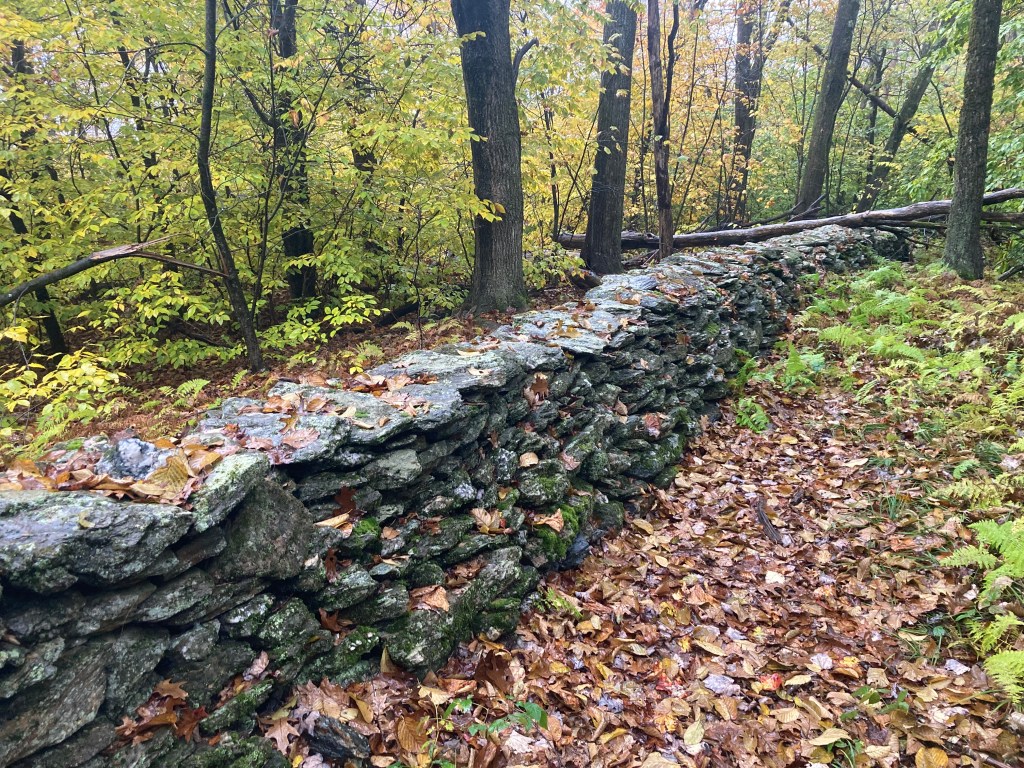
General info: Holy Mount (sometimes called Doll Mountain South) is a fascinating peak in the Taconic Mountains, straddling the border between Hancock, Massachusetts, and New Lebanon, New York. The actual summit is in Hancock. The mountain is part of Pittsfield State Forest. The summit is wooded and without views but instead you will find interesting ruins associated with the Hancock Shaker Village, a religious community founded in 1791 and active until 1960, located at the foot of Holy Mount and adjacent Shaker Mountain. The Shakers used Holy Mount for religious gatherings (more on that below). Other ruins releated to the Shaker community can be found along the trails leading to the summit. The Taconic Ridge continues northward to adjacent Doll Mountain (hence Holy Mount is sometimes called Doll Mountain South) and southward to Perry Peak. East of Holy Mount is Shaker Mountain, another peak associated with the community.
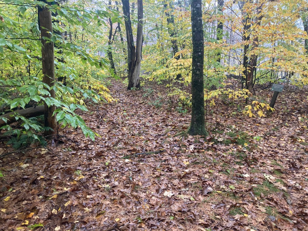
Historical background: Shaker communities were known for their innovative architecture, craftsmanship, and communal lifestyle as part of the United Society of Believers in Christ’s Second Appearing (but by outsiders, more commonly called Shakers). In the 19th century, the Shaker community from Hancock held religious ceremonies on Holy Mount, considering it a sacred site. These gatherings, often involving the entire community, were significant spiritual events. The mountain’s western spur, Mount Lebanon, is named after the nearby Mount Lebanon Shaker Village in New York, highlighting the interconnectedness of Shaker communities in the region. Hikers traversing the Shaker Trail, which begins at the historic Hancock Shaker Village (now a living-history museum), will encounter these historical ruins and remnants and can read interesting signage placed by the Shaker Village Museum. Most notable, at the summit of Holy Mount, there are stone walls and building foundations–the remains of structures used by the Shakers during their religious gatherings. In another spot closer to the foot of the mountain, a curve in the mountain slope creates a natural amphitheater which was used for prayer meetings.
Recommended ascent routes:
The Shaker Trail Loop: The trail network around Holy Mount and Shaker Mountain is limited–there’s really only one trail up and over the mountain, the Shaker Trail. If you follow the whole loop, it will take you over two Mass 50 Highest Public Peaks–Holy Mountain and Shaker Mountain. As mentioned above, there are lots of interesting historic sites and ruins along the way. There is plenty of parking at the large parking area on Route 20 across from the Hancock Shaker Village. This full loop is about 5.5 miles with about 1,100 feet in elevation gain.
Nearby Mass 50 Highest Public Peaks: As noted, Shaker Mountain is a near neighbor, a hike of these two together is a perfect day hike. If you want to go further, Perry Peak to the south is within hiking distance and connected by trails. Smith Mountain to the north, also within Pittsfield State Forest, could be included if you want a longer hike.
Click photos to enlarge:

Leave a comment