Mass Public Peaks elevation rank: #33
Elevation: 2,008 feet
Prominence: 932 feet
Isolation: 22.5 miles
Summit coordinates: 42°23’35.4″N 73°18’39.2″W
Town: Princeton, Massachusetts
Conservation Area: Wachusett Mountain State Reservation
Links:
Wachusett Mountain on Peakbagger
Wachusett Mountain on ListsofJohn
Wachusett Mountain on Wikipedia
Wachusett Mountain State Reservation (including trail map)
Wachusett Mountain State Reservation on Alltrails
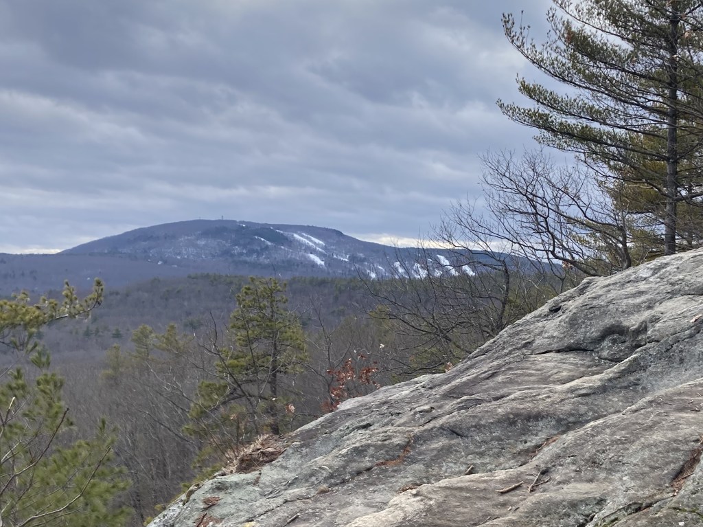
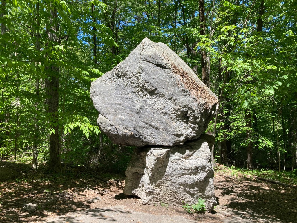
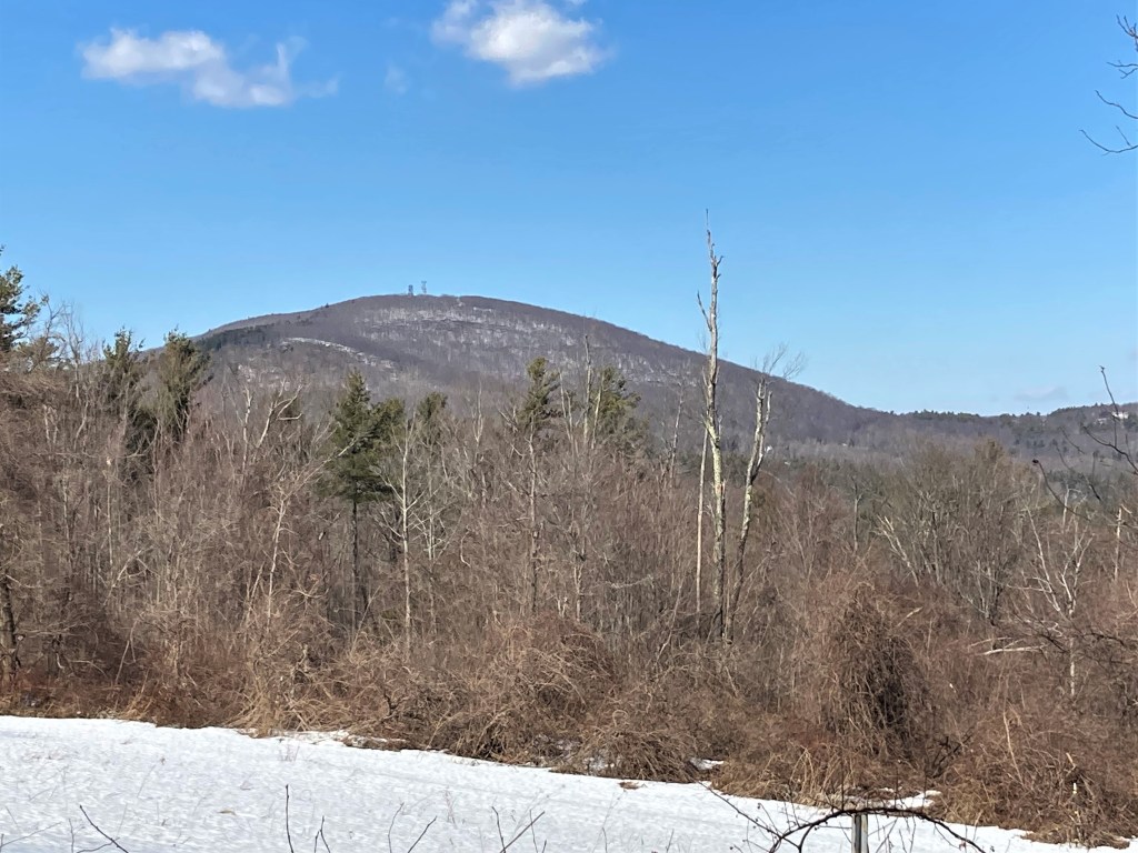
General info: Wachusett Mountain, standing at 2,008 feet, is the highest peak in Massachusetts east of the Connecticut River. The Wachusett Mountain State Reservation encompasses over 3,000 acres, providing year-round recreational opportunities. There are 17 miles of hiking trails, including a section of the 92-mile Midstate Trail that traverses the mountain. An intriguing spot on the slopes is Balance Rock (see photo below), located on the northeast side. This geological feature demonstrates the power of glacial activity that shaped the mountain thousands of years ago during the Ice Age. Here, two massive boulders, each roughly the size of a small car, are stacked on top of one another, a natural balancing act. In the winter months, the privately operated Wachusett Mountain Ski Area offers skiing and snowboarding. The summit provides panoramic views, with sights extending to Mount Monadnock in New Hampshire to the north, Mount Greylock to the west, southern Vermont to the northwest, and the Boston skyline to the east.
Historical background: Before European colonial settlement, Wachusett Mountain and the surrounding area were home to the Nipmuc people, a Native American tribe that lived across central Massachusetts. The name “Wachusett” is derived from an Algonquin term meaning “near the mountain” or “mountain place,” Wachusett played a notable role during King Philip’s War (1675–1676), a devastating conflict between Native American tribes and English settlers. In 1676, the mountain served as a temporary base for Native forces, including those under the leadership of the Wampanoag sachem Metacom (known to the English as King Philip). It was during this period that Mary Rowlandson, a colonist who had been taken captive during a raid on the town of Lancaster, was brought to the area. The Nipmuc and their allies negotiated her release at nearby Redemption Rock, a granite outcrop in Princeton that remains a historical site today.
In the 1930s, the Civilian Conservation Corps (CCC) played a significant role in developing recreational facilities on Wachusett Mountain, including the construction of ski trails. During World War II, the 10th Mountain Division trained on the mountain, and a plaque at the summit commemorates this history. The mountain’s old-growth forests, with trees ranging from 150 to over 370 years old, have been a focal point for conservation efforts, highlighting the area’s ecological significance.
Recommended ascent routes: With such a large network of trails, there a many different ways to summit Wachusett. Check the AllTrails app for a variety of possibilities.
Balance Rock and Old Indian Trail: This is essentially the route I took up Wachusett (though I took the Semuhenna Trail down). Lots of parking available at the ski area on the north side of the mountain and a prominent trail head. The trails were fairly busy, being a beautiful fall day. The Old Indian Trail out and back is about 3 miles and 1,000 feet of elevation gain.
Bicentennial, Mountain House, and Pine Hill Trail: Another popular starting point is at the State Reservation parking area on the east side of the mountain. A variety of trail combinations are possible here. This one is about 2.3 miles and 800 feet of elevation gain.
Nearby Mass 50 Highest Public Peaks: Wachusett is the third most isolated peak in Massachusetts. So, you won’t find any other listed 50 Highest Public Peaks in hiking distance. But if you’d like an interesting hike nearby, try the Crow Hills in Leominster State Forest. Very dramatic cliffs and some fine views.
Back to Massachusetts 50 Highest Public Peaks list
Click photos to enlarge:


Leave a comment