Mass Public Peaks rank: #29
Elevation: 2,084 feet
Prominence: 258 feet
Isolation: 4.51 miles
Summit coordinates: 42°26’25.6″N 73°09’37.6″W
Town: Hinsdale, Massachusetts
Conservation Area: Appalachian Trail Corridor
Links:
Tully Mountain on Peakbagger
Tully Mountain on ListsofJohn
Massachusetts Appalachian Trail map
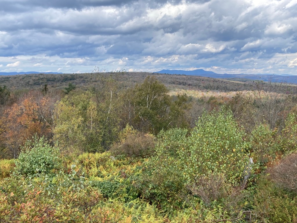
General info: Tully Mountain sits on the western edge of the central Berkshires and is the highest point in Hinsdale. It should not be confused with a smaller Tully Mountain in Orange, Massachusetts. The Appalachian Trail crosses near its summit, though the true high point is about 200 feet southwest of a noticeable bend in the trail. Bushwhack just a bit off the trail at the summit and you will find a fallen telephone pole (which I presume once held an antenna). Follow the telephone pole to its rocky footing and you’ve found the actual highpoint. But for those not so concerned with exact highpoints, passing by on the AT is extremely close. Tully Mountain is densely wooded, with no views at the summit or along the trail nearby. By contrast, Warner Hill, farther south on the AT, features a pleasant fern meadow and scenic views. Tully feels a bit more humdrum in comparison. For a quick afternoon hike, the most practical route starts at the AT parking area on Blotz Road, south of the mountain. This starting point is up on the ridge and so there is minimal elevation gain, aside from a gentle saddle between Warner and Tully. For through-hikers heading south from Dalton, the experience is much different, involving a steep climb from the valley floor. As always, the challenge depends on your approach. For day hikers, the steeper northern ascent isn’t an option due to the lack of parking on that side.
Historical background: Despite being one of the highest points in the state, and a prominent feature on the AT, Tully Mountain tends to be a bit overlooked. I can find virtually nothing about its historical background nor can I determine for whom it was named. Perhaps some information will crop up in time.
Recommended ascent routes:
Tully Mountain and Warner Hill from Blotz Road: This was my route to Tully Mountain from the parking area on Blotz Road. About 5.75 miles and roughly 735 feet of elevation gain. As noted, this starting point is up on the ridge, so the verticle gain is nothing strenuous. From Warner Hill, the first peak you reach, there is a fine view west to Pittsfield and north to Mount Greylock.
Nearby Listed Peaks: Adjancent Warner Hill is also on the 50 Highest Public Peaks and coming from the south, you can’t avoid bagging Warner on the way to Tully. Other listed peaks are a bit of a drive but the many peaks in Pittsfield State Forest are not far.


Leave a comment