Mass Public Peaks rank: #25
Elevation: 2,177 ft.
Prominence: 251 ft.
Isolation: 0.99 miles
Summit coordinates: 42°28’57.9″N 73°20’07.2″W
Town: Hancock, Massachusetts
Conservation Area: Pittsfield State Forest
Links:
Smith Mountain on Peakbagger
Smith Mountain on ListsofJohn
Pittsfield State Forest website (including trail map)
Pittsfield State Forest on Alltrails
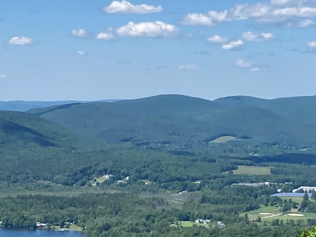
General info: Smith Mountain is located in Pittsfield State Forest which boasts an outstanding network of trails. It is part of the Taconic Mountain Range, situated along the Massachusetts-New York border, with its summit lying within the town of Hancock. The mountain is part of a chain of hills running north to south through the state forest, a popular recreation area offering amenities such as parking, campsites, picnic spots, cross-country skiing, and other facilities. The summit is wooded but not densely…there are hints of views, especially to the northwest. The Smith Mountain Trail is a pretty route right up to the summit. The actual highpoint is just off the east side of the trail–a few rocks piled against a tree marks the spot.
Historical background: Pittsfield State Forest was officially established in the early 20th century as part of a broader movement to conserve natural resources and create public recreation areas. The land includes several old Native American trails and at the time of acquisition consisted of overused farmland, degraded forests, and abandoned properties. During the Great Depression, the Civilian Conservation Corps (CCC), a New Deal program, played a significant role in transforming the forest into a public space. The CCC workers constructed roads, trails, and facilities while reforesting large areas with pine, spruce, and hardwood trees. Their efforts not only rejuvenated the land but also provided jobs during a time of economic hardship. I haven’t been able to determine who Smith Mountain was named for. Perhaps some information will turn up.
Recommended ascent routes:
West Mountain and Smith Mountain Loop: This was my route to Smith Mountain, a hike I enjoyed very much. I parked at the very end of West Street in Pittsfield where Lebanon Springs Road (a gated dirt road, closed off to vehicles) veers off. Just at the beginning of Lebanon Springs Road, on public land near the gate, there is a small pullout with room for maybe two cars. A little snug, but parking is allowed there. The West Mountain trail is very nice, fairly steep. At the top of West Mountain there is a fine view, including a peek of Smith Mountain itself, the neighbor to the north. As mentioned, with the leaves down there are partial views from Smith Mountain. My descent took me along the CCC trail, which felt like a very old woods road but may have been cut by (as the name would suggest) the CCC in the 1930s, or perhaps they widened and leveled it. Alongside, Lilly Brook creates a small gorge with Doll Mountain rising sharply on the other bank. Very pretty area. In all about 5.2 miles and 1,050 feet of elevation gain.
Nearby Mass 50 Highest Public Peaks: Seven different listed peaks lie within Pittsfield State Forest, so there are plenty of opportunities to summit others on the Mass 50 Highest Public Peaks list. Pine Mountain is closest to the north and Berry Mountain just a bit beyond that. If you planned out a different route from the one I took, you could easily get all three in an afternoon. Holy Mount and Shaker Mountain are to the south but further away.
Click photos to enlarge:


Leave a comment