
Mass Public Peaks rank: #18
Elevation: 2,299 ft.
Prominence: 199 ft.
Isolation: 0.94 miles
Summit coordinates: 42°31’25.5″N 73°18’35.4″W
Town: Hancock, Massachusetts
Conservation Area: Pittsfield State Forest
Links:
Poppy Mountain on Peakbagger
Poppy Mountain on Wikipedia
Pittsfield State Forest website (including trail map)
Pittsfield State Forest on Alltrails
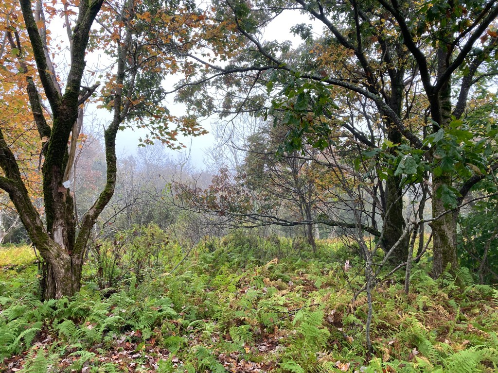
General info: Poppy Mountain is part of the Taconic Mountain Range, located along the border of Massachusetts and New York. Its summit lies within the town of Hancock, its eastern slope extends into Lanesborough, and a western spur known as Pease Ridge extends into New York state. The mountain is part of a chain of hills running north to south through Pittsfield State Forest, a popular recreation area offering amenities such as parking, picnic spots, and other facilities. There is a meadow at the summit that is fairly well hemmed in by trees, limiting any potential views. But it’s quite pleasant there with its expanse of ferns, a nice place to sit for a rest or lunch. The highest point of the mountain appears to be situated directly along the Taconic Crest Trail as it crosses through the meadow. The Taconic Crest Trail, by the way, is one of my favorites in Massachusetts, especially the stretch that runs from Misery Mountain to Berlin Mountain and Mount Raimer in New York. Beautiful woods and lots of varied terrain up and over the various peaks of the Taconics. It runs for 37 miles from Route 20 in Hancock to Route 346 in North Petersburgh, NY right on the New York/Vermont border. Poppy Mountain is one of the three “Mass 50 Highest Public Peaks” that the TCT summits.
Historical background: In 1934, as part of the New Deal work programs, the Civilian Conservation Corps (127th Company) established a large camp at Pittsfield State Forest. They undertook several projects, including the construction of new ski and hiking trails and a road leading up to Berry Pond (the highest natural body of water in Massachusetts) on nearby Berry Mountain. The small building that served as their camp headquarters still stands and is now used by the State Park. This historic structure is located at the foot of Honwee Mountain near Lulu Cascade, adjacent to a parking area that is one possible option for reaching Poppy Mountain (see suggested routes below). As for the reason for Poppy Mountain’s name (or any of its variants for that matter–Pease Ridge or Poppy Top), it’s unclear. Perhaps some information will surface.
Recommended ascent routes:
Poppy Mountain from Potter Mountain Road: This was my route to Poppy Mountain. I post it for reference, but I do so with one word of caution: I took the Burgoyne Trail up to the ridge…and that was a mistake. That trail is basically abandoned and in awful condition. I came down the Daniels Brook Trail which was in beautiful condition, scenic and lovely. At any rate, there’s good parking at the Pittsfield State Forest parking area on Potter Mountain Road in Pittsfield. Take the Daniels Brook Trail up to the Taconic Skyline Trail (not to be confused with the Taconic Crest Trail). Follow the TST south a little bit to a side trail that will take you to the TCT and the summit of Poppy Mountain. This route is about 4.3 miles and 1,000 feet of elevation gain.
Poppy Mountain via Honwee Mountain: Here is map of another good route, beginning at the Lulu Brook parking area of Pittsfield State Forest (off of Berry Pond Circuit Road), and running up the scenic Lulu Brook Trail to the Honwee Loop Trail. Take a quick detour southeast along the Honwee Loop Trail to bag Honwee’s summit, then backtrack to find the Taconic Skyline Trail. From there its a short ways to Poppy Mountain. Then get back to the TST to trail Lulu Brook Trail and follow that right out. This route would be about 5.8 miles with about 1,350 feet in elevation gain and bags two “Mass 50 Highest Public Peaks.”
Nearby Listed Peaks: As noted, there are plenty of opportunities to include other listed peaks in this area. Honwee Mountain and Berry Mountain to the south are the closest. Widow White’s Peak to the north is further but the Taconic Skyline Trail will take you there.

Leave a comment