Mass Public Peaks rank: #11
Elevation: 2,538 ft.
Prominence: 339 ft.
Isolation: 0.5 miles
Summit coordinates: 42° 38′ 42” N, 73° 8′ 49” W
Town: Adams, Massachusetts
Conservation Area: Mount Greylock State Reservation
Links:
Ragged Mountain on Peakbagger
Ragged Mountain on ListsofJohn
Mount Greylock State Reservation (including link to trail map)
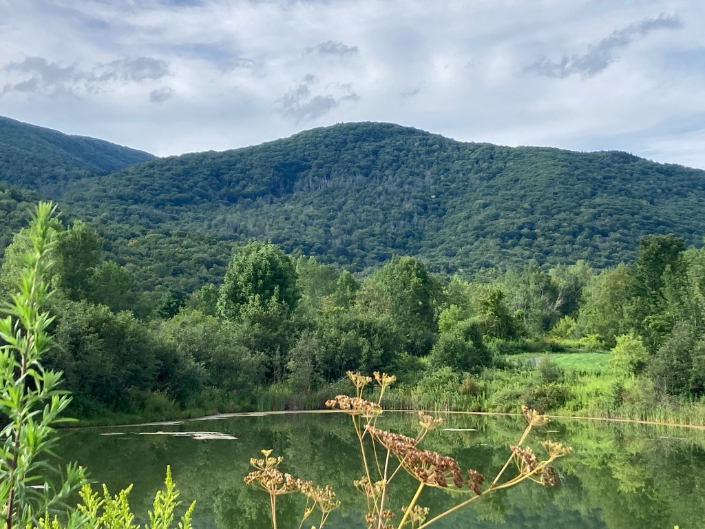
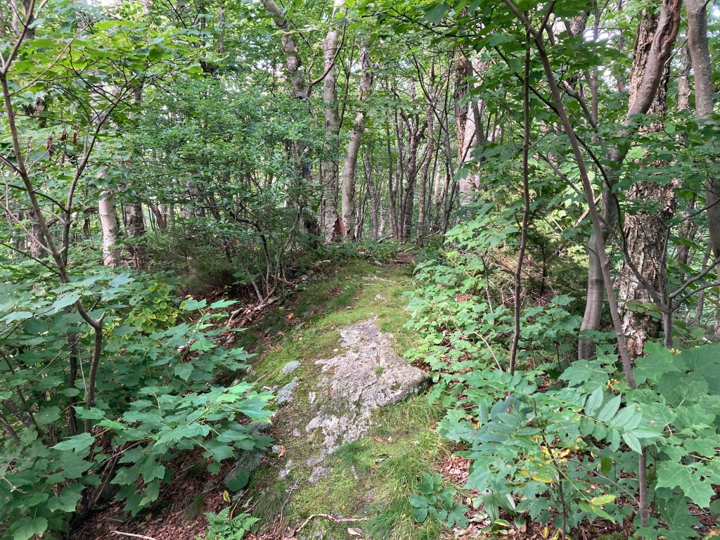
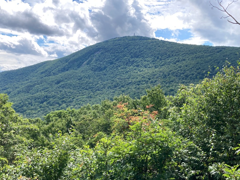
General info: Ragged Mountain, while the lowest of my ranked peaks in the Mount Greylock State Reservation, remains a worthwhile and challenging climb–one of my favorites. It sits on the east side of the Greylock Massif, which is itself a subrange of the Taconic Mountains. Along the trail, a rocky outcropping near the summit provides a stunning vantage point with an outstanding view of Mount Greylock, the reservation’s towering centerpiece. I lingered there for quite some time, taking in the landscape. There are also some dramatic outcroppings on the north side of the mountain known as “Raven’s Rocks”, though I did not know about these when I was there. Will have to go back. A lot to see here. Though overshadowed by its more famous neighbor, Ragged Mountain has enough prominence to stand as an independent peak in its own right. Its rugged trail and amazing vistas make it a good destination for hikers seeking a quieter, yet equally rewarding, experience within the Greylock Reservation.
Historical background: Ragged Mountain is one of the few Massachusetts peaks on my list with a ghost story attached to it—more on that in a moment. The mountain was once known as “Ravenscrag,” a name I much prefer. Ravens are indeed a common sight in the Greylock Reservation—you can scarcely hike here without hearing their distinctive calls or spotting a pair soaring above a rocky outcropping. The rugged, rocky landscape, however, is the mountain’s most distinctive feature and likely inspired its current name.
The Mount Greylock State Reservation, established in 1898 as Massachusetts’ first public land designated for forest preservation, spans over 12,000 acres and includes several peaks within the Greylock Range. An early Greylock Commission report described Ravenscrag as “an interesting geological study,” and its steep drop-offs and uneven terrain still set it apart from its neighbors. The base of these outcroppings features several sizable caves, though I haven’t explored them.
As for the ghost story, local lore claims that the Bellows Pipe Trail, which leads to Ragged Mountain, is haunted by the spirit of a hermit—a Civil War veteran from North Adams who lived in a makeshift shelter somewhere nearby the trail and reportedly died alone. Skiers descending the Thunderbolt Trail have even claimed to see his apparition near the intersection of Thunderbolt and Bellows Pipe, in an area known as Greylock Glen.
Recommended ascent routes: A DCR trail map can be found here. There is really only one way to reach the summit–the Ragged Mountain Trail from the southwest. There was another, the Ragged Mountain Path, running straight up a ravine from the south, but this is presently closed. Don’t try it. I tried coming down it. There are no “closed” signs up top, only at the bottom, and I didn’t realize it was closed until the undergrowth started getting extremely thick.
Ragged Mountain via Bellows Pipe Trail South Trailhead and Ragged Mountain Trail: A route of about 4.25 miles and 1,375 feet elevation gain. Starting from the Bellows Pipe South Trailhead (plenty of parking), I took the historic and very pleasant Bellows Pipe Trail, passing the supposedly haunted intersection with the Thunderbolt, a couple mountain brooks and some beautiful scenery. At a prominent sign, I turned right onto the Ragged Mountain Trail which gets quite steep but only for a short while. As mentioned, the Ragged Mountain Path running south is closed, so I recommend doubling back to your starting point.
From Bellows Pipe Trail North Trailhead: You could also approach the Ragged Mountain Trail from the north, parking at the Bellow Pipe Trail North Trailhead on Notch Road in North Adams. This route runs about 5.2 miles and has about 1,230 feet of elevation gain.
Nearby Listed Peaks: The Greylock Massif consists of a number of peaks, some of them prominent enough to be considered independent. Several nearby are on the Mass Public Peaks list including Greylock itself, Mount Prospect, Stony Ledge, Saddle Ball Mountain, and Rounds Rock. Those interested in a longer hike could include any of these with Ragged Mountain, particularly Greylock itself which would make for a good hike.
Click photos to enlarge:

Leave a comment