
Mass Public Peaks rank: #8
Elevation: 2,587 ft.
Prominence: 569 ft.
Isolation: 3.15 miles
Summit coordinates: 42°40’35.4″N 73°04’03.5″W
Town: North Adams, Massachusetts
Conservation Area: Hoosac Range Reserve
Links:
Spruce Hill North on Peakbagger
Spruce Hill North on ListsofJohn
Hoosac Range Reserve on Berkshire Natural Resources Council website (including trail map)
General info: Perhaps the most important thing to know about Spruce Hill North is that, despite being the highest point in the Hoosac Range Reserve, it isn’t the main attraction of this trail network (sorry, Spruce Hill North, but it’s true). Its neighboring subpeak, simply called Spruce Hill, is only 0.6 miles to the south along the Hoosac Range Trail. Just 50 feet shorter, the southern Spruce Hill—I wish it were called ‘Spruce Hill South’ for clarity—features a craggy summit with spectacular vistas and a great trail leading right to the top. It’s truly one of the best viewpoints for Mount Greylock and the Hoosic River Valley in all of western Massachusetts. It lacks the prominence to make the Mass Highest 50 Public Peaks list, but be sure not to miss it.
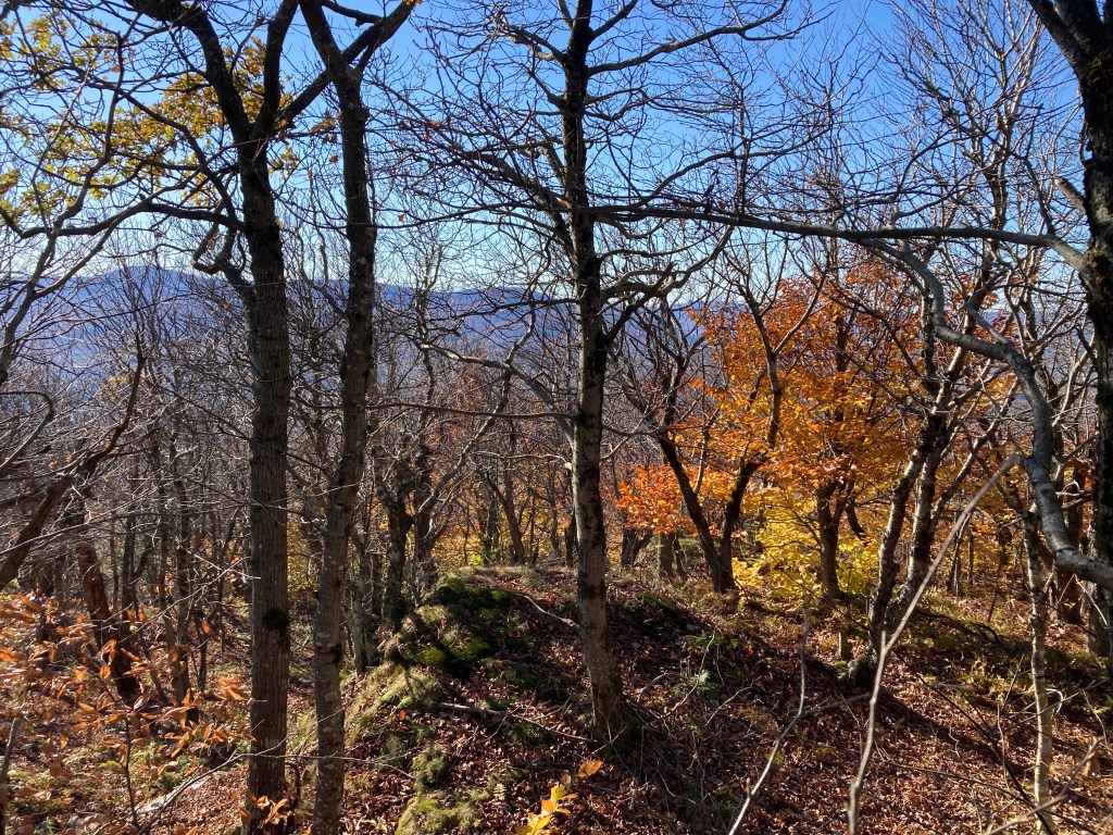
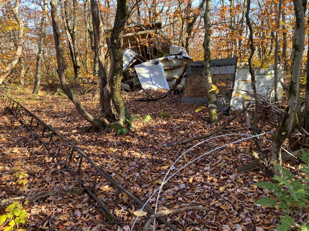
By contrast, Spruce Hill North is wooded, and while the Hoosac Range Trail passes just 200 feet west of the highpoint, reaching the true summit requires a short bushwhack off-trail. The highpoint is clearly marked by the ruins of an old radio tower and equipment shed—not as inspiring as Spruce Hill’s peak, but still the highest point in this part of the Berkshires and worth checking off your list.
Historical background: The Hoosac Range forms the western wall of the Berkshires. To the west, the land drops sharply into the Hoosic River Valley and the city of North Adams. Historically, the ridge posed a significant barrier for travelers. The original Mohawk Trail, now largely Route 2, served as the main footpath across this ridge for centuries and lies about 2 miles north of Spruce Hill North.
In the 19th century, the Hoosac Tunnel was cut deep through the mountain range to allow rail transport. The tunnel passes close to the summit of Spruce Hill North, though about 1,000 feet below it. To ensure the tunnel’s alignment, a series of stone alignment towers was built along the ridge directly above the planned tunnel path, aiding in accurate surveying. About a tenth of a mile south of Spruce Hill North, just off the east side of the Hoosac Range Trail, lies the foundation of one of these towers. It is now marked by two large power line poles. Though now just a pile of rubble, it remains an interesting site. There are other alignment towers along the ridge that are better preserved but more difficult to access.
If you approach from the south through Savoy Mountain State Forest, you’ll pass the remarkably well-preserved foundations of the old Busby Farm—a fascinating site to explore. It must have been a truly isolated existence for the family that lived there.
Recommended ascent routes: There are two ways to access this peak, from the south or from the north. Both routes have excellent trails and interesting features, but I would recommend the southern route along the Busby Trail first.
Busby Trail to Spruce Hill and Hoosac Range Trail to Spruce Hill North–4 miles, about 890 feet elevation gain. This southerly route travels through Savoy Mountain State Forest. A state trail map can be found here. Park at Busby Trailhead on Center Shaft Road in Savoy. As mentioned, this trail will take you to the foundations of the Busby Farm high on the slope of Spruce Hill and then to the stunning vistas of Spruce Hill itself. From there, continue north for about 0.6 miles, hooking up with the Hoosac Range Trail to get to Spruce Hill North.
Hoosac Range Trail to Spruce Hill North and on to Spruce Hill–On AllTrails here. 5 miles, about 870 feet elevation gain. Park at the Hoosac Range Trail parking area on Route 2 in North Adams not far from the famous Hairpin Turn on the Mohawk Trail. Be sure to stop at Sunset Rock about a half mile in for a great view to the north. Spruce Hill North will be about 2 miles in. Then be sure to go another half mile or so to the spectacular vistas on Spruce Hill.
Nearby Listed Peaks: There aren’t any other listed peaks in convenient hiking distance from Spruce Hill North. But the Greylock Massif with its many listed peaks is just a short drive away. Spruce Mountain in Monroe State Forest is also nearby as is isolated Borden Mountain.
Back to Massachusetts 50 Highest Public Peaks list
Click images to enlarge:


Leave a comment