
Mass Public Peaks rank: #7
Elevation: 2,609 ft.
Prominence: 1,664 ft.
Isolation: 32.14 miles
Summit coordinates: 42° 6′ 7” N, 73° 25′ 57” W
Town: Mount Washington, Massachusetts
Conservation Area: Mount Everett State Reservation
Links:
Mount Everett on Peakbagger
Mount Everett on ListsofJohn
Mount Everett on Wikipedia
Mount Everett State Reservation Website (including trail map)
Mount Everett State Reservation on Alltrails
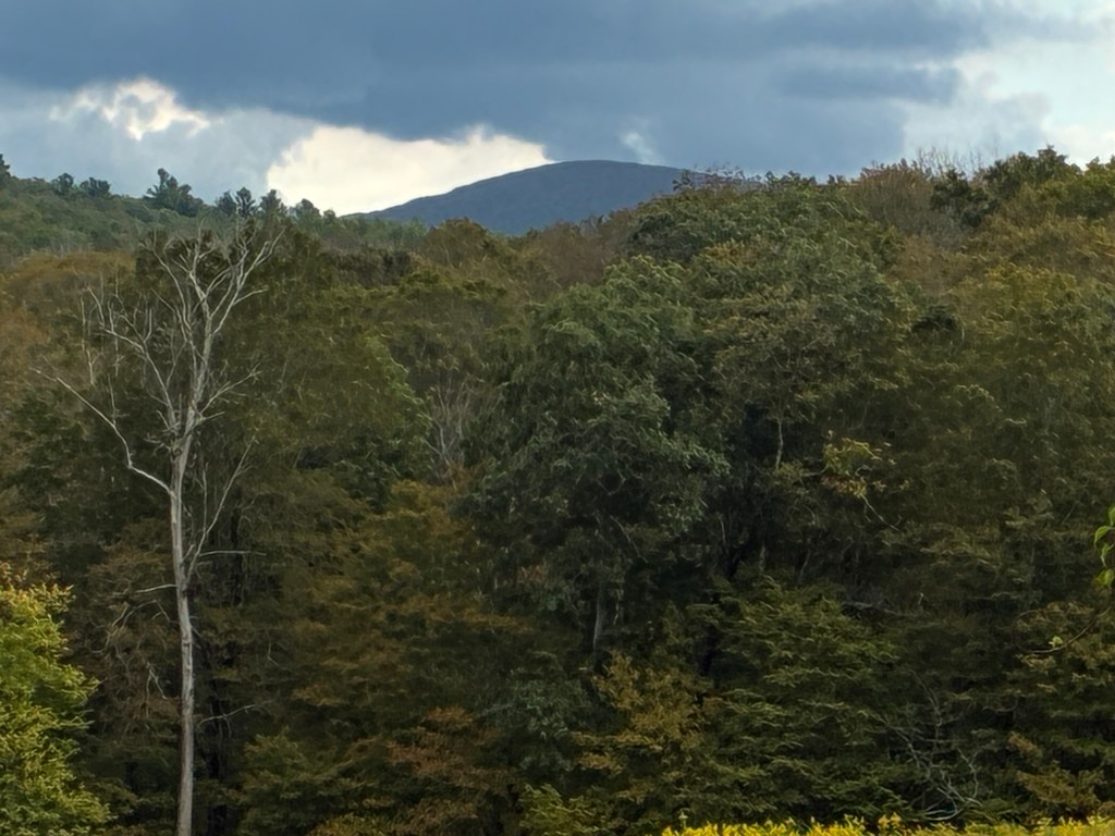
General info: Mount Everett is the largest mountain in the southern part of the Taconic Range. In terms of prominence (not elevation), it is second only to Mount Greylock. And it takes the #1 spot in the state in terms of isolation at 32 miles. This makes it a challenging climb no matter how you approach it. It lies within the Mount Everett State Reservation which consists of nearly 2,500 acres of conservation land purchased by the Commonwealth in the early 1910s. The Appalachian Trail traverses the reservation and crosses the summit of Mount Everett. The area is known for sections of old growth forest, scenic Guilder Pond (the second highest natural pond in Massachusetts), and Race Brook Falls. The reservation is close to or abuts several other areas of conservation land, including Mount Washington State Forest, making for a large region open to hiking and other recreation. Because Mount Everett is so isolated, it takes the brunt of the weather and the trees at the summit are therefore unusually low and scrubby. This allows for an excellent, nearly 360 degree view.
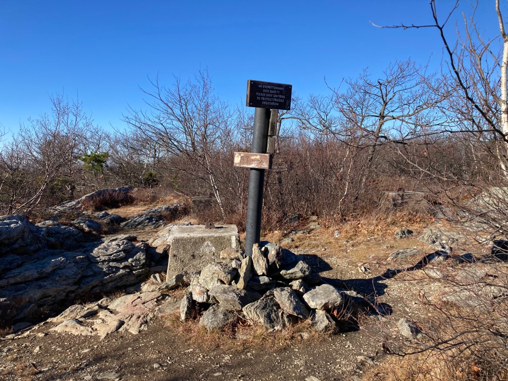
Historical background: In the 18th century, Mount Everett was known as Taconic Mountain (with various spellings) and also as Bald Mountain—a name that still appears on some USGS maps. In 1841, Edward Hitchcock, the chief of the Massachusetts Geological Survey and later President of Amherst College, proposed renaming it “Mount Everett” after Edward Everett, a prominent Massachusetts politician, former Governor, and future U.S. Senator. Hitchcock believed the mountain, which he described as “in many respects…the finest in Massachusetts,” deserved a name that connected it to the state’s “history and literature.” Hitchcock’s description of the summit view is filled with a Transcendentalist sense of wonder: “O what a glorious display of mountains all around you, and how does one in such a spot turn round and round, drinking in new glories and feeling his heart swell with emotions of sublimity until the tired optic nerve shrinks from its office.” Although some locals initially resisted the new name, preferring the traditional “Dome of the Taconics” or “Dome Peak,” Hitchcock’s proposal eventually prevailed. From 1905 to 2002, a fire tower stood at the summit; its footings can still be seen today.
Recommended ascent routes: Both these routes begin at the Race Brook Falls Trailhead parking area on Route 41 (South Undermountain Road). Plenty of parking available.
Mount Everett via Race Brook Falls Trail–About 6.25 miles and 1,900 feet elevation gain out and back. Race Brook Falls is scenic, not very large as falls go, but pleasant. This trail gets quite steep in places, I found it fairly challenging. Some fun twists and turns. View from Mount Everett summit is excellent.
Mount Everett and Mount Race via Race Brook Falls Trail–The same as above but extending the hike to include Mount Race to the south, which also has a nice view. Mount Race gets a little craggy in places. A fun hike, but at 7.5 miles and about 2,500 feet in elevation gain, I found this one challenging (and rewarding!).
Nearby Listed Peaks: As mentioned above, Mount Race is a close neighbor and is easily paired with Everett on a day hike. Mount Frissell, Alander Mountain, Mount Darby, and Prospect Hill are all part of the Mount Washington massif and are an easy drive away if you wanted to bag one or more in the same trip. But me, after doing both Everett and Race, I was fairly cooked for the day.
Back to Massachusetts 50 Highest Public Peaks list
Click photos to enlarge:


Leave a comment