Mass Public Peaks rank: #4
Elevation: 2,717 ft.
Prominence: 321 ft.
Isolation: 0.7 miles
Summit coordinates: 42°42’18.5″N 73°00’20.2″W
Town: Monroe, Massachusetts
Conservation Area: Monroe State Forest
Links:
Spruce Mountain on Peakbagger
Spruce Mountain on ListsofJohn
Monroe State Forest on Wikipedia
Monroe State Forest Website (including trail map)
Monroe State Forest on Alltrails
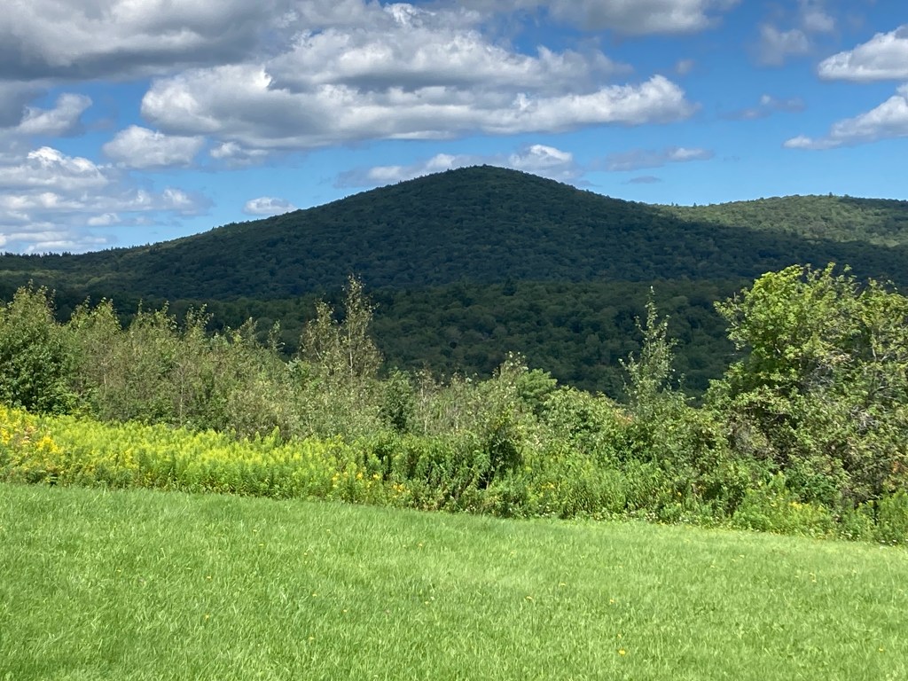
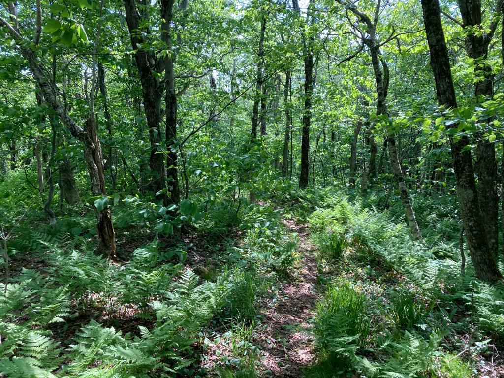
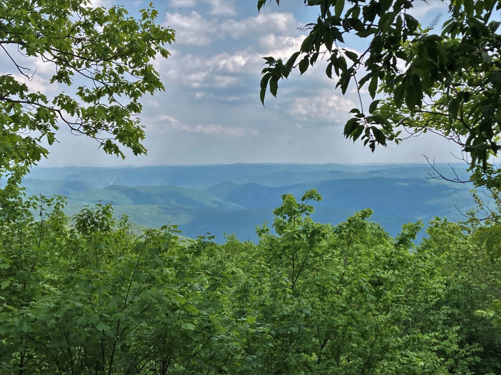
General info: Spruce Mountain, part of the northern Berkshire Range, is located near the Vermont border in the isolated Monroe State Forest. The area is the most sparsely populated in the state. Due to this fact, and the extremely steep slopes of Spruce Mountain, a good deal of old growth forest still survives within the boundries of this state park. Indeed, the area feels ancient, and in my three times hiking there, I’ve never seen another soul. Spruce Mountain itself is a moderately challenging climb (although on the day I actually targeted and hiked the summit it was about 90 degrees and felt seriously challenging). There’s really only one loop (see remarks on the route below). There is a vista at the end of a very short side trail just a few steps south of the main trail that summits the mountain. It is a narrow view, but quite pleasing.
Historical background: This landscape has been home to people long before the first roads. The uplands around Spruce Mountain lay at the edge of Algonquian territories. The Mahican (Mohican) tribe originally inhabited the Hudson River valley. After about 1680 the Mohicans were pressed out by Iroquois incursions, and many migrated into western Massachusetts (forming the Stockbridge community, among others).
European settlement of Monroe came relatively late and was always sparse. Indeed, it is the smallest town by population in mainland Massachusetts. In the early 1800s the town (incorporated 1822) was essentially a logging and subsistence farming community. Farmers cleared what they could on the steep slopes, and I have read that there are still foundations and cellar holes still visible along the trails of Monroe State Forest (though I did not spot any ruins on my hikes, I’m sure they’re there somewhere). Monroe’s economy hinged on small sawmills on the Deerfield River; when those mills declined in the late 19th and early 20th centuries, many farms were abandoned.
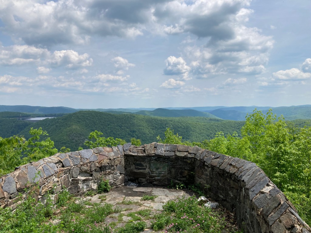
In 1924, recognizing the forest’s watershed and scenic value, Massachusetts officially set this land aside as Monroe State Forest. The state’s purchase consolidated hundreds of former farm lots into one unit. During the Great Depression the Civilian Conservation Corps improved the new park: CCC crews built roads, bridges and park features, most notably the stone Raycroft Lookout overlooking the Deerfield Gorge. In the postwar period Monroe State Forest continued to evolve under conservation. Notably, in the 1960s the remote Spruce Mountain drew interest from ski developers. Technical studies identified it as a promising ski area and plans for chairlifts and a base lodge were put forward. However, the state never approved large-scale development on the DCR land. Those ambitious ski plans for Spruce Mountain were ultimately dropped.
Because the mountain’s steep slopes were left undisturbed, Monroe State Forest retained its wild character. Today it remains largely undeveloped: managed by DCR for “conservation and recreation.” Spruce Mountain and its woods still feel like a true backcountry – far from roads, and free of commercial ski lifts or logging roads.
Recommended ascent routes: A DCR trail map can be found here.
Spruce Mountain Loop–The loop I followed ran 6.7 miles with 1,355 feet of elevation gain. It’s the only loop that summits Spruce Mountain. I recommend proceeding in a clockwise manner, easterly along the Monroe Road (a dirt access road) and taking the Hunt Hill Trail as a diversion out and back to the Raycroft Outlook. This is an old stone terrace constructed by the Civilian Conservation Corps during the 1930s with a splendid view of the Deerfield River Gorge. From here, proceed up the Spruce Mountain Trail to the summit and the narrow vista there. The westerly side of the Spruce Hill Trail is windy and vague in many places. Easy to lose track of. I strongly recommend using a GPS app like Alltrails to stay on track. This hard to follow westerly section is the only downside to an otherwise great loop.
Nearby Listed Peaks: It’s fairly isolated, so there are really no other listed peaks that you could get to on foot. Hop in the car and the Spruce Hill North trailhead is not far away (they really liked using the name “Spruce” on many different peaks in this area). Mohawk Trail State Forest (including listed peaks Clark Mountain, Todd Mountain, and the adjacent Negus Mountain) are just a short drive away.
Back to Massachusetts 50 Highest Public Peaks list
Click photos to enlarge:

Leave a comment