Mass Public Peaks rank: #1
Elevation: 3,492 ft.
Prominence: 2,468 ft.
Isolation: 26.65 miles
Summit coordinates: 42° 38′ 14” N, 73° 9′ 57” W
Town: Adams, Massachusetts
Conservation Area: Mount Greylock State Reservation
Links:
Mount Greylock on Peakbagger
Mount Greylock on ListsofJohn
Mount Greylock on Wikipedia
Massachusetts Mount Greylock State Reservation Website
Mount Greylock State Reservation on Alltrails
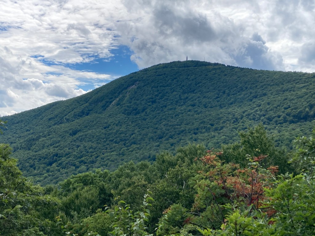
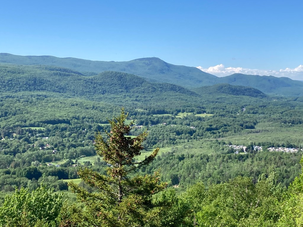
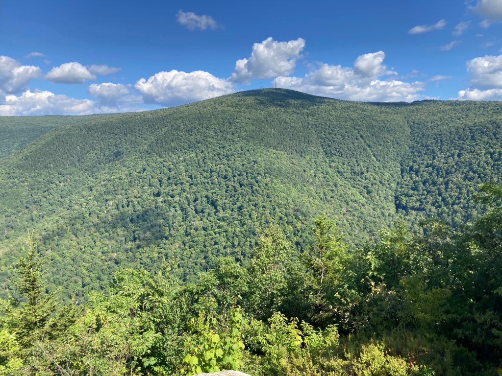
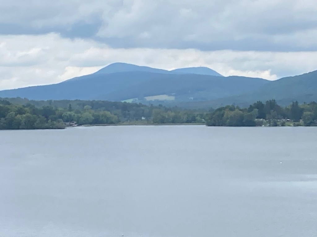
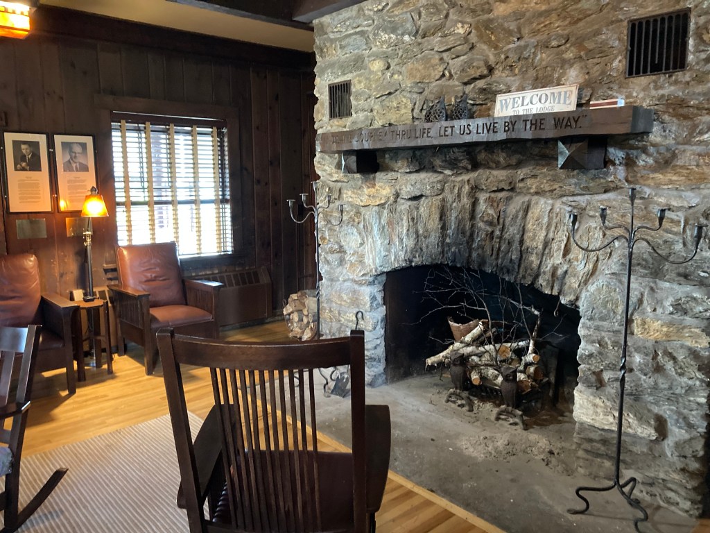
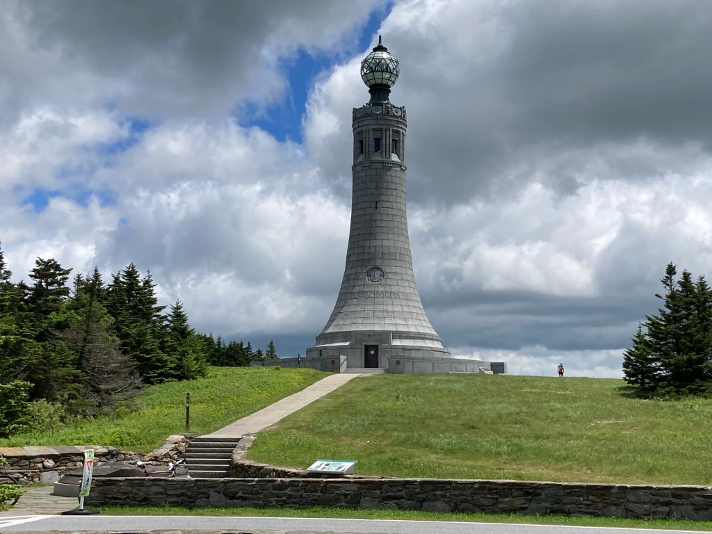
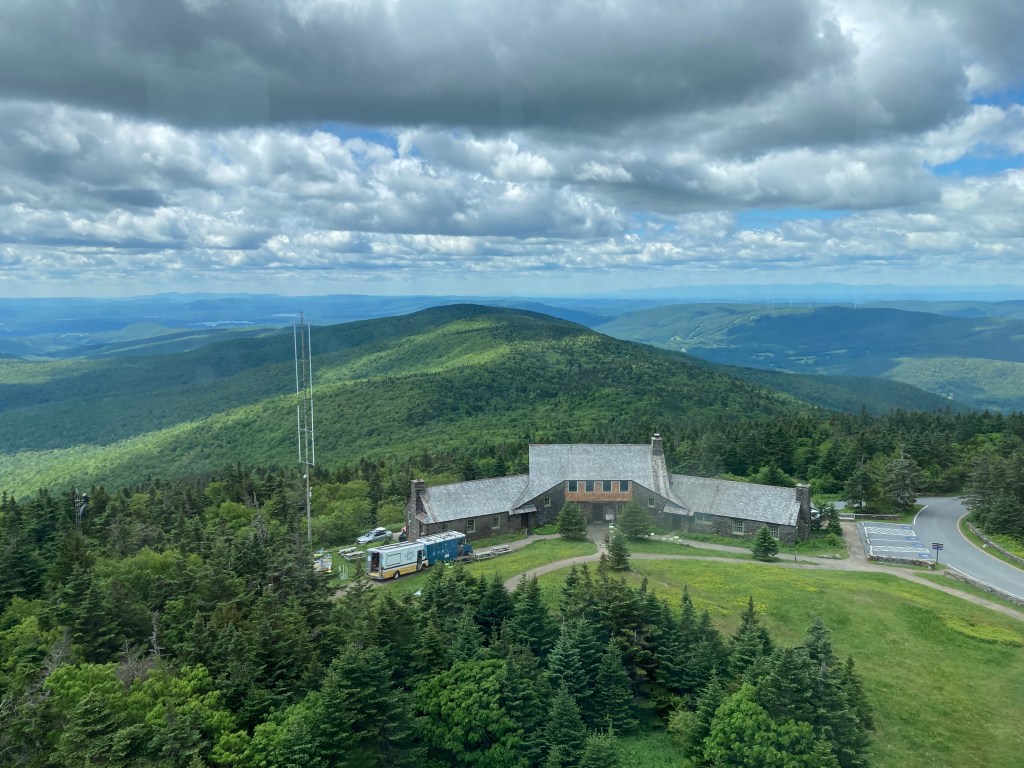
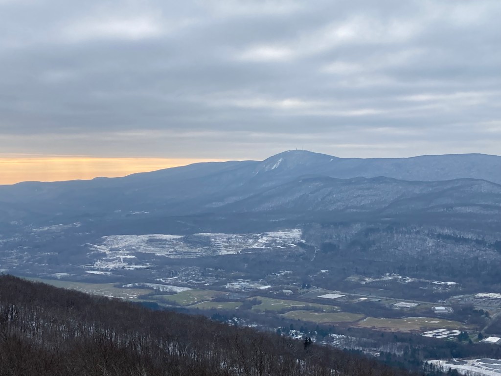
General info: Mount Greylock, the highest point in Massachusetts, is part of the Taconic Range and offers one of the most iconic summit experiences in Massachusetts. From its broad, rounded top—capped by open meadow and marked by the 93-foot Massachusetts Veterans War Memorial Tower—hikers can enjoy panoramic views stretching up to 90 miles on a clear day, with sightlines reaching into New York, Vermont, Connecticut, and New Hampshire. The summit area also includes Bascom Lodge, a rustic 1930s stone lodge offering seasonal meals. While the summit is likely to be crowded during the fair-weather months, don’t let that deter you. The surrounding Mount Greylock State Reservation encompasses 12,500 acres of quieter trails and scenic wilderness.
Greylock’s upper slopes support a rare sub-alpine boreal forest of balsam fir and red spruce—the only taiga-like ecosystem in Massachusetts. On the mountain’s west side, stands of old-growth hemlock and 200-year-old red spruce have been designated a National Natural Landmark. Over 70 miles of hiking trails wind through the reservation, including an 11.5-mile stretch of the Appalachian Trail, which crosses the summit. A seasonal paved auto road allows car and bike access to the top from May through late October (weather permitting).
If you reach the summit in good weather, I highly recommend climbing the Veterans War Memorial Tower. The interior of the tower is architecturally striking, and the 360-degree views from the top windows are just about the most impressive in western Massachusetts. You won’t get the same field of view from ground level due to the tree line—though there are still excellent north and east-facing views just outside the tower for those who find it closed or prefer to stay below.
Historical background: (There’s more to say about this one historically than most…so this will be a longer history section than most). Long before European settlers arrived, the Berkshires were home to the Mahican (Mohican) people, who lived in the valleys surrounding what is now Mount Greylock. Though no specific Indigenous name for the mountain survives, it likely held meaning in Native oral geography. Early Anglo settlers referred to it as “Grand Hoosuc” and “Saddleback Mountain” due to its distinctive profile when viewed from the south. That old name lives on in Saddle Ball Mountain, Greylock’s prominent southern summit ridge.
The name “Mount Greylock” began appearing in the early 19th century and is widely believed to honor Chief Gray Lock (Wawanolewat), a Western Abenaki leader born near present-day Westfield, Massachusetts. Gray Lock led a guerrilla campaign against English settlements in the 1720s and was known for his shock of silver hair—possibly echoing the mountain’s frequently cloud-capped summit. There’s no evidence that he ever visited the peak, but the name stuck, likely popularized by Williams College professor Albert Hopkins, and by 1819, it appeared on local maps.
Greylock’s commanding presence drew early attention. In 1799, Timothy Dwight IV, president of Yale, and Ebenezer Fitch, the first president of Williams College, climbed the mountain and noted how its summit was often “capped by clouds” and seen as a local weather indicator. By the 1830s, Williams College students had cut the Hopper Trail up the west side and even built Griffin’s Tower, a wooden observation tower on the summit, for meteorological study.
In the mid-19th century, Greylock became a beacon of literary and artistic inspiration. Nathaniel Hawthorne hiked it in 1838 and later set part of his haunting short story “Ethan Brand” there. Herman Melville, from his farm in Pittsfield, admired the mountain daily—particularly in winter, when its snow-covered summit reminded him of a giant white whale. Local lore suggests that image helped shape his vision of Moby Dick. In fact, Melville dedicated his novel Pierre to “Greylock’s Most Excellent Majesty,” calling the mountain his “sovereign lord and king.” Henry David Thoreau climbed the mountain solo in July 1844—via what is now the Bellows Pipe Trail—and later reflected on it in A Week on the Concord and Merrimack Rivers, crediting the experience with giving him the confidence to live in solitude at Walden Pond the following year.
As tourism increased in the late 1800s, Greylock’s slopes faced heavy deforestation and brush fires from logging operations. In 1885, local businessmen formed the Greylock Park Association (GPA), built a 60-foot iron tower on the summit, and opened Notch Road—a carriage road from North Adams. Visitors paid a toll to drive up and climb the tower. Despite early success, the GPA struggled financially. In response, Massachusetts created the Mount Greylock State Reservation in 1898—the Commonwealth’s first state-owned park—starting with 400 acres and later expanding to protect the entire massif.
Through the early 20th century, Berkshire County managed the reservation, adding new hiking trails, improving access, and opening Rockwell Road from the south in 1907. The Appalachian Trail was routed over the summit in 1929, and by 1931, the entire Massachusetts stretch of the AT was completed. In the 1930s, a wave of WPA and CCC projects brought lasting changes to the summit landscape. Crews built or enhanced roads, trails, and lean-tos. Between 1932 and 1938, they constructed Bascom Lodge, the still-operating stone lodge at the summit. They also completed the Massachusetts Veterans War Memorial Tower in 1932—a 93-foot granite monument honoring World War I soldiers (later rededicated to all state veterans). The tower has at times functioned as a navigational beacon, with light shining through its translucent globe.
One of the CCC’s boldest efforts was the creation of the Thunderbolt Ski Trail in 1934, a 1.6-mile backcountry ski racing trail plunging over 2,000 feet from the summit’s eastern slope. For a time, it hosted sanctioned International Ski Federation races. Competitors had to hike to the top with their skis, making the Thunderbolt legendary among early alpine racers. Though no longer an official ski area, the trail has been reclaimed by backcountry skiers in winter and used by hardy hikers in warmer months—its steep grade makes it quite a challenge.
After World War II, Mount Greylock again faced development threats. In the 1950s, proposals were floated to build a tramway and ski resort on its slopes, but thanks to grassroots advocacy led by the Mount Greylock Protective Association, those plans were defeated. In 1966, the state took over full management of the reservation from Berkshire County, formalizing its commitment to long-term conservation and public enjoyment.
Mount Greylock is one of the few Massachusetts peaks that has a ghost story attached to it. The spot in question (the junction of the Thunderbolt Ski Trail and the Bellows Pipe Trail) is actually closer to adjacent Ragged Mountain and is along the way to that peak, so I relate some of the details on that page.
Recommended ascent routes: The Mount Greylock State Reservation covers about 12,000 acres and is full of excellent trails. A DCR trail map can be found here. Here are just a few suggested routes to the summit as shown on Alltrails.
Cheshire Harbor Trail–6.2 miles out and back, 1,916 feet elevation gain. This one is probably my favorite. Large parking area at the end of West Mountain Road. Moderate steepness most of the way up. A very nice day-hike.
Bellows Pipe Trail–5.9 miles out and back, 2,244 feet elevation gain. Parking near the end of Gould Road. More rigorous in terms of grade. The Bellow Pipe Trail, as I understand it, is an old and historic route. Passes some brooks and small waterfalls.
Hopper Trail including Stony Ledge–8.6 mile loop, 2,536 feet elevation gain. Parking at Hopper Road lot. If you’re feeling adventurous, take the steep Hopper Trail from the west side of Greylock. The return route will take you over Stony Ledge (#10 on the Mass Public Peaks list) which has majestic views of Greylock and the impressive “Hopper” (a glacial cirque like a colossal amphitheatre).
Thunderbolt Ski Trail via Bellows Pipe Trail–3.8 miles out and back, 2,162 elevation gain. Park at Gould Road lot. The bold can take the Bellows Pipe Trail to the historic Thunderbolt Ski Trail for a steep climb.
Appalachian Trail from the North–Another one for the bold, this steep and lengthy route will take you over Mount Williams (#3 on the Mass Public Peaks list). It’s a beautiful trail.
Nearby Listed Peaks: The “Greylock Massif” consists of a number of peaks, some of them prominent enough to be considered independent. Creative routes could be designed to include some of the following on the Mass Public Peaks list: Saddle Ball Mountain, Mount Williams, Stony Ledge, Ragged Mountain, Mount Prospect, and Rounds Rock. Hitting them all in one go would be a very long trek indeed, but I’m sure there are those who have done it.
Back to Massachusetts 50 Highest Public Peaks list.
Click photos to enlarge:

Leave a comment